|
| |
Links: Previous
map for Bluebeard -- Next map for Bluebeard
Maps for Jaws
-- Maps for Bunga --
Maps for Elsie -- Maps for Tasha
Birds
of Prey page -- Osprey
main page -- Migration
page -- Home
Page
|
|
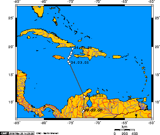
24 March 2005. Bluebeard
has taken on the Caribbean and isn't interested in a rest stop on Jamaica
or Hispaniola. We have no locations for him until we picked him up
southeast of Jamaica (the first point in the Caribbean). It appears he was
changing course as we picked up his signal. After heading northwest since leaving Colombia,
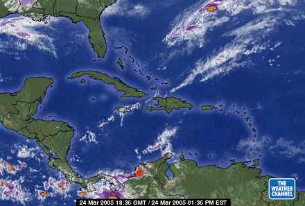
he ran into a weather front just
southeast of Jamaica (scroll down to
see a radar image of the weather he was flying through), which may have
changed his ground direction. In other words, he could have been
continuing to fly in a northwesterly direction, but strong winds out of the west
would have pushed him east.
In the stretch of points we have for him over the
water he flew 166 mi in 7.5 hours, for a ground speed of just over 22 mph.
At that rate, this 650 mi. (1047 km) trip would have taken him 29 hours of
non-stop flying. He is a stud.
Our last fix
for him on the 24th was just about 20 miles (30km) off the coast of Cuba.
And then we lost all signals from him for 24 hours. We were getting lots
of signals from Jaws' radio, which meant the lack of a signal from
Bluebeard was not because the satellites weren't receiving or transmitting
signals.
Have we lost another bird just a few miles short
of landfall? See the next map...
|
|
|
|
Birds
of Prey page -- Osprey
main page -- Migration
page -- Home
Page
|