Katbird - 2011
'09 maps for:
Bea
--
Buck -- Caley --
Claws --
Conomo --
Hix --
Hudson 09 -- Isabel --
Katy -- L.R. --
Moffet --
Mr. Hannah --
Ozzie --
Penelope
--
Rafael
2010 maps for: Belle
-- Buck --
Gunny --
Hudson --
Mr. Hannah --
Neale --
North Fork Bob
--
Penelope --
Sanford
-- Sr. Bones --
Thatch
2011 maps:
Belle --
Buck --
Henrietta --
Katbird
-- North Fork Bob --
Pemi --
Saco --
Sanford --
Sr. Bones --
Snowy --
Thatch -- Tucker
2012 maps: Art --
Belle --
Bridger --
Chip --
Cutch --
Jill -- North Fork Bob --
Rammie --
Snowy --
Sr. Bones -- Thatch
2013 maps: Art --
Belle --
Bridger --
North Fork Bob --
Rammie --
Snowy --
Sr. Bones
Osprey
main page --
Migration
page --
Migration09 --
Migration10 --
Migration 11 --
Migration 12 --
Migration 13 -- Home
Page
 |
25 May-17 July 2011.
Our newly
tagged adult male, Katbird, took a tour of the
lower tier of New England states after his nest
failed. He hung around
the nest for about 3 weeks and then took a road
trip. After a week off-Island, he returned to the Vineyard for the rest of the summer and then started his migration on the 26th of Sept. He's now out over the Caribbean, facing some nasty weathert. His route has been very unusual. Almost all adults fly south to S.A. from Hispaniola, but he made it all the way to the British Virgin Islands before heading south. Scroll down for all his maps, or... Skip ahead to the start of fall migration. |
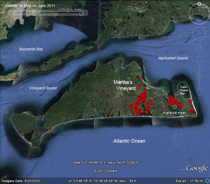 |
25 May-6 June 2011. Surprisingly, Katbird appears to do most of his hunting over at Edgartown Great Pond. I had expected to see him hunting more on Chappaquiddick itself, especially in the shallow Cape Pogue Bay, which seems like it should be perfect for an Osprey to fish. |
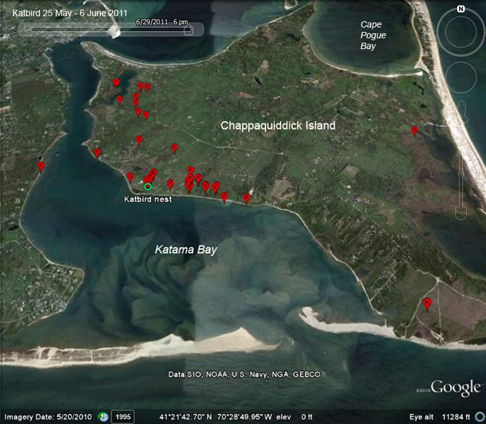 |
25 May-6 June 2011. When he wasn't over at Edgartown Great Pond, Katbird spent some time around the nest and its vicinity. Only 1 trip over to Poucha Pond near East Beach. |
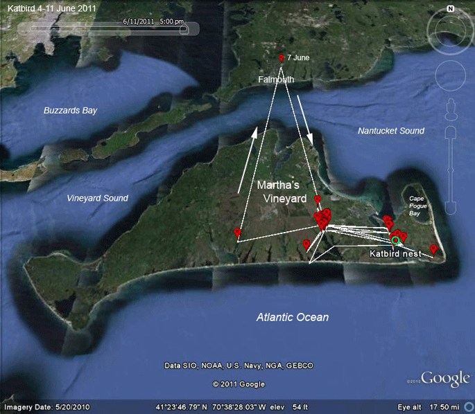 |
4-11 June 2011. Katbird spent most of this week at the head of Edgartown Great Pond. He took a quick, 1-hr trip up to the Cape and then returned to Edgartown Great Pond. |
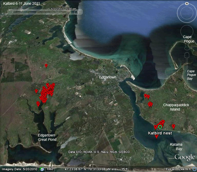 |
6-11 June 2011. A close up of the main areas where Katbird has been hunting. There clearly is an abundant source of fish in the upper reaches of Edgartown Great Pond. Looks like the all-you-can-eat buffet is open. |
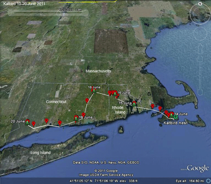 |
14-20 June 2011. Katbird took off on the 15th. He spent a couple of days in northeastern Connecticut, where our adult Ospreys so often go after their nests fail, and then pushed on west through Connecticut. |
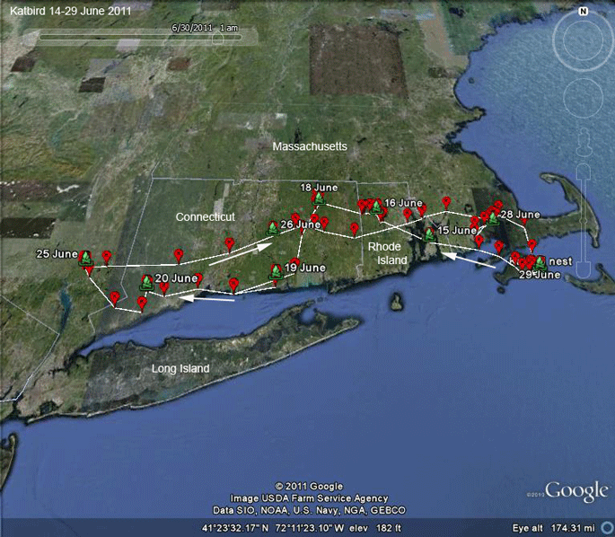 |
14-29 June 2011. Katbird got to Oscawana Lake in NY, just 5 miles east of West Point, on the 21st. He spent 4 days there and then pretty much flew straight home, although he did spend two nights near Marion on Buzzards Bay before returning to the Vineyard. |
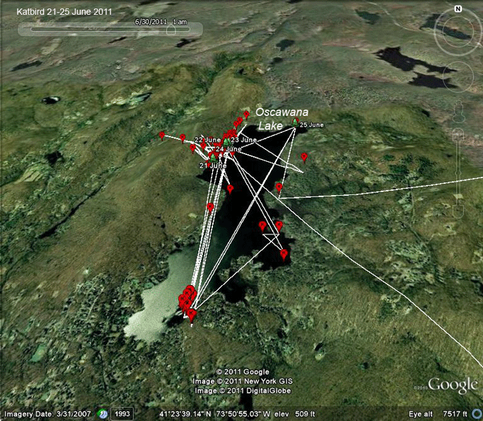 |
21-25 June 2011. Katbird spent 5 days just east of the Hudson River around Oscawana Lake... |
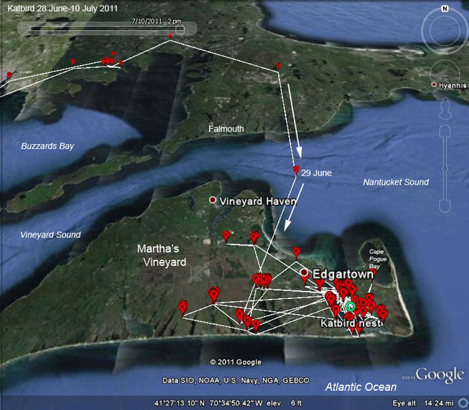 |
28 June - 10 July 2011. ...and then was home four days later. |
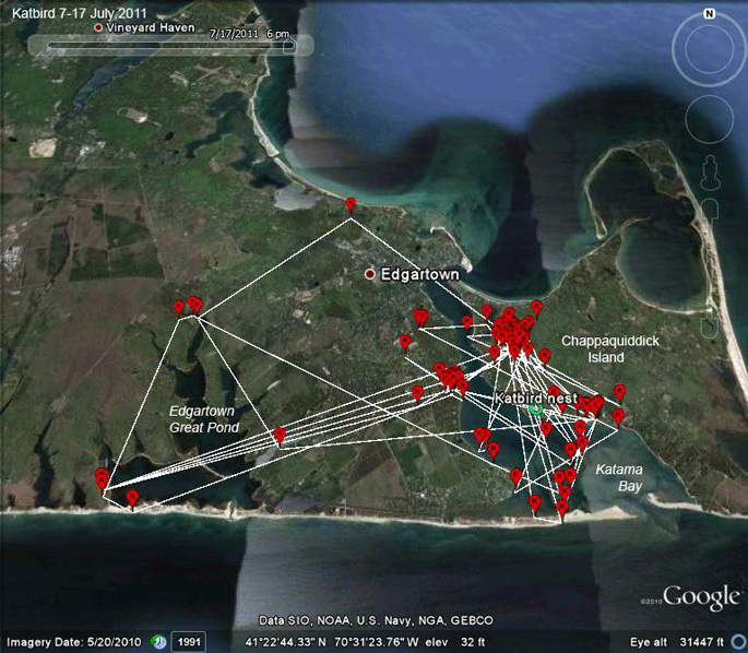 |
7-17 July 2011.
Katbird
apparently wasn't paying much attention to his
nest. He may have been there off and on, but he
wasn't there for any of his hourly GPS fixes. In contrast to earlier in the summer, he spent very little time at Edgartown Great Pond. |
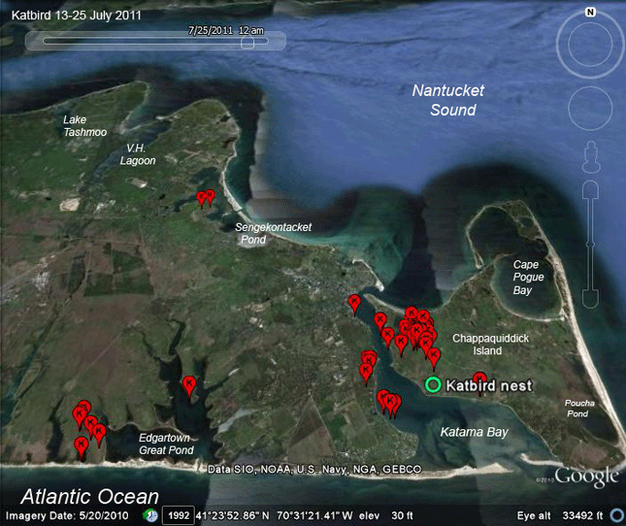 |
13-25 July 2011.
Katbird must
have had it pretty easy this week. Not much
movement. |
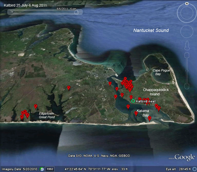 |
25 July - 6 Aug 2011. So what about the cluster of locations we keep seeing north of his nest? Scroll down... |
 |
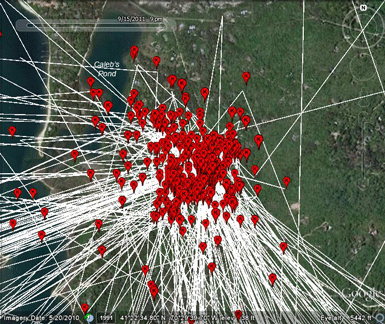 |
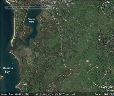
| This hillside above Caleb's Pond and the eastern shore of Katama Bay is the Katbird's favorite hangout between fishing bouts. There's no water around, so his time here is just idle time. Maybe he's playing Angry Birds on his iPhone. | These are the GPS locations for the whole summer. He's here more than anywhere else. The thick cluster of tracks heading southwest go straight over to Edgartown Great Pond, where he spent a lot of time hunting in July. |
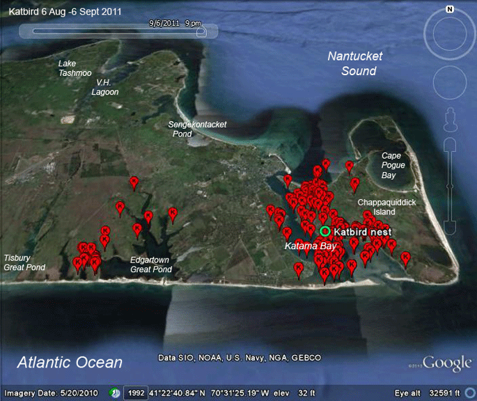 |
6 Aug - 6 Sep 2011.
Katbird's just
biding time before heading south, which should
be any day now. (Except the weather has been
terrible.) He's been fishing a lot in Katama bay, with occasional forays over to a small pond just west of Edgartown Great Pond. (Hey Luanne, what's the name of this pond?) |
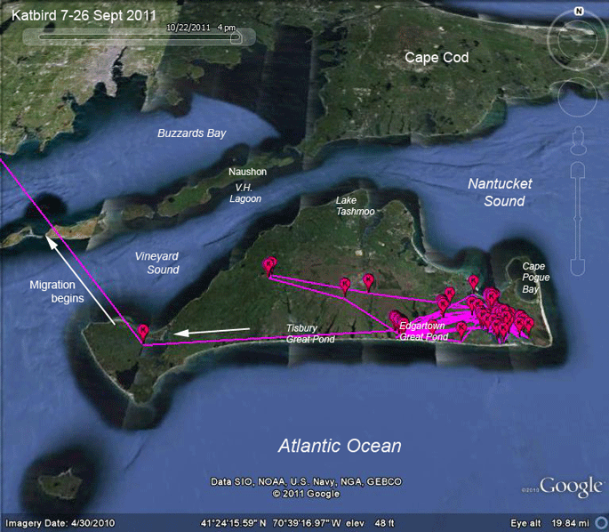 |
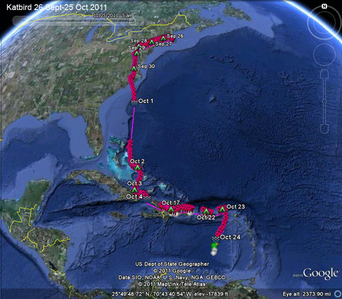
7-26 Sep
2011.
Katbird spent
the last 2 and a half weeks before migrating
bouncing back and forth between Katama Bay and
Edgartown Great Pond. On the 25th he made a bit
of a move west that looked like he was starting
his migration, but then retreated to home base.
On the 26th he started migrating for real. He left home around 10:30 AM, passed over Menemsha at 11 and then headed northwest towards the Westport River area. |
 |
26-28 Sep 2011. Katbird moved through southern New England quickly, settling down on the 27th in northern New Jersey. On the 28th he moved 138 miles southwest into Pennsylvania, roosting just west of Lancaster, PA, near the Susquehanna River. |
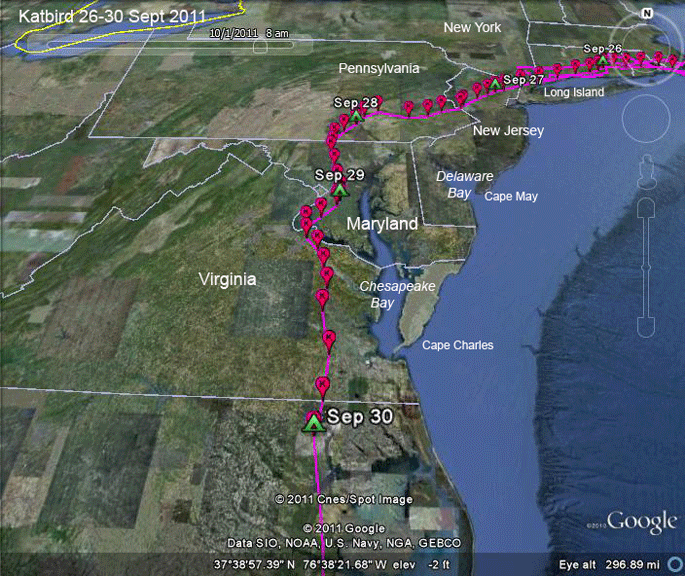 |
27-30 Sep 2011. Katbird slalomed between Baltimore (leaving it to his left) and D.C. (to his right) on his way to northern North Carolina. At this point, he's traveled 638 miles. |
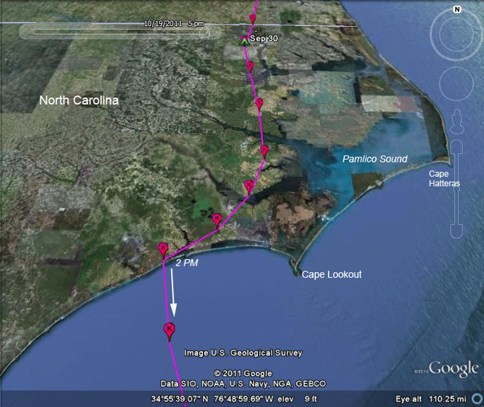 |
1 Oct 2011. Katbird started migrating on the 1st about 8 AM. Six hours later he passed through Swansboro, NC, and then kicked off over open water, heading for points south. Adults that do this usually wind up making landfall somewhere along Florida's eastern coast. |
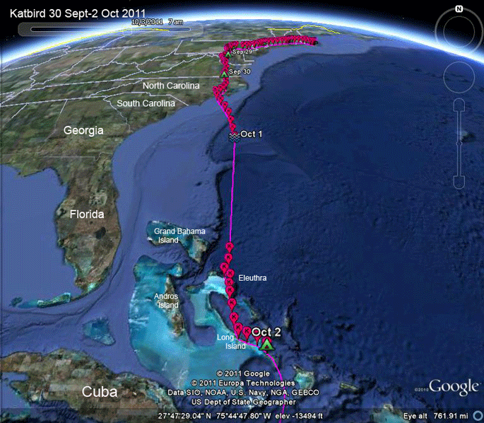 |
1 Oct 2011. Katbird sped across 645 miles (1,038 km) of open Atlantic ocean, apparently with strong tailwinds, probably out of the northwest, which would explain why he wound up in the Bahamas, rather than Florida's east coast, where most adults leaving North Carolina's coast usually make landfall. During the first six hours he was flying 36 mph (58 kph), which is very fast for an Osprey. Typically, they fly about 20-25 mph (32-50 kph) when migrating. He slowed down a bit over the next 14 hours, but his overall average was still 30 mph (48 kph). |
 |
1 Oct 2011.
When he
reached land (Eleuthra Island) about 26 hours
after leaving North Carolina on the 30th, it
appears he didn't even stop to rest. If he did
stop, in was only for less than half an hour
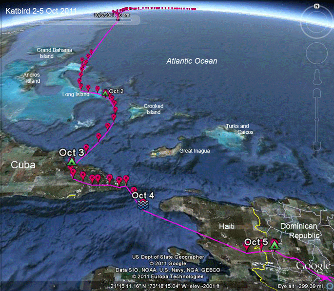
somewhere on the south end of Eleuthra. He did finally settle down on Long Island (that's the Bahama's version not New York's!) after passing through Georgetown. After a night on Long Island, he got off to a midmorning (10 AM) start to the next leg of his migration. About 9 hours later he arrived in southeastern Cuba. His average speed over the water was 22 mph (35 kph). No tailwinds this time. 9 AM start on the 4th, with a probable fishing stop around 1 PM. He stayed over Cuba as long as possible and then headed out over open water around 5 PM. He flew through the night and landed somewhere in Haiti sometime that night and roosted across the D.R. border on the 5th. |
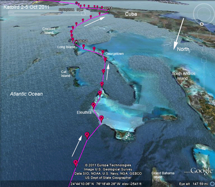 |
2-3 Oct 2011. Here's another view of his passage through the Bahamas, looking southeast, sort of over his shoulder. |
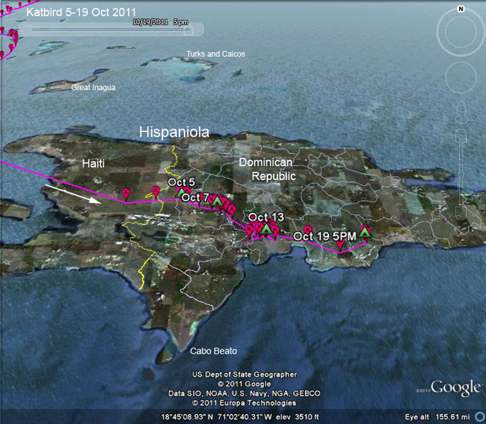 |
5-19 Oct 2011.
(Looking north again)
Katbird pretty
much stopped his migration in the D.R. for a
couple of weeks. This is probably some
combination of bad weather and the need to fuel
up after the push from the States. On the 19th he seemed to get going again, although it's surprising that an adult is moving this far east through the D.R. Most adults know the short-cut to South America passes over Cabo Beato, the south facing peninsula on Hispaniola's south shore. |
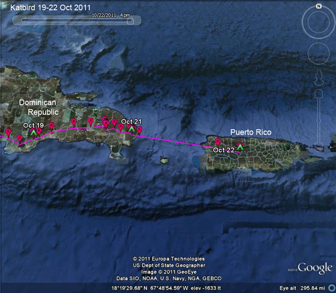 |
19-22 Oct 2011.
Katbird's on
an unusual path here. I think we've only had one
other adult make it to Puerto Rico and only a
few juveniles. Maybe this is where he winters, but I doubt it. I suspect he'll cross the Caribbean and settle down somewhere in South America. There's a tropical storm brewing due south, so I hope he waits a while before heading south, if that's what's in his future. |
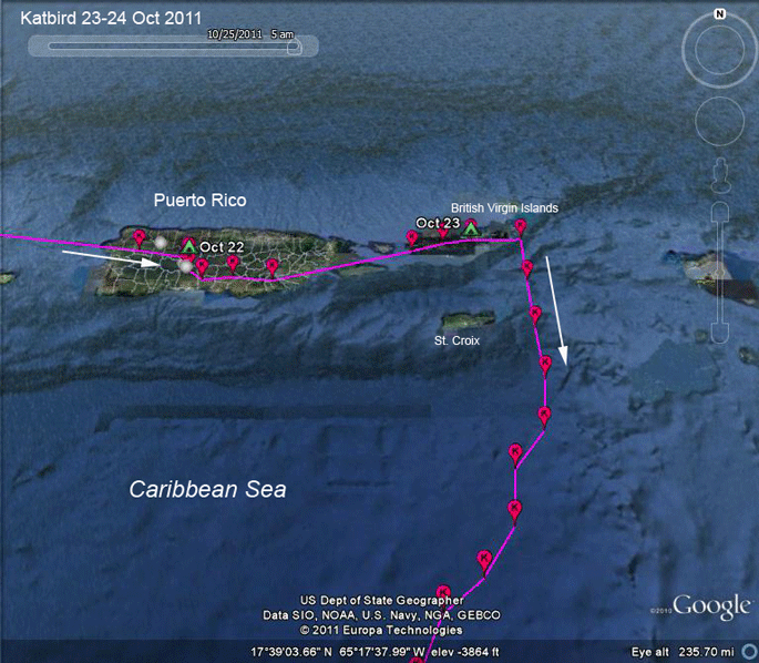 |
22-24 Oct 2011.
Katbird has
gone where no bird we've followed has been
before-to the British Virgin Islands. Because this is the first time we've followed this bird, we don't know if he normally takes this "long cut" to South America. We don't have a GPS fix for him before he headed south across the Caribbean, but it appears that he made it all the way to Virgin Gorda, the very last of the BVIs, before heading south. |
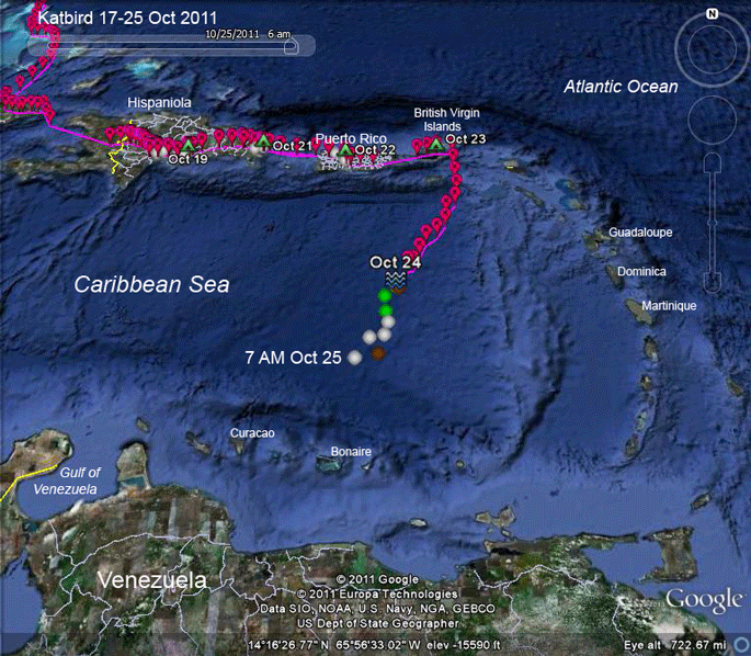 |
22-24 Oct 2011.
Katbird is out
over the middle of the Caribbean in the midst of
some nasty weather (see next map). The colored points are the satellite-calculated locations that we get when the transmitter uploads GPS data after the GPS unit has stopped recording. While they're not as accurate as the GPS points, they do tell us that Katbird is still moving. He's about 150 miles (250 km) from the closest island where he could rest. |
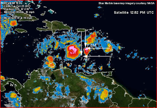 |
24-25 Oct 2011.
Katbird's
location at 1 AM on the 25th is indicated by the
two arrows. After the terrible fall we had last
year, losing 4 birds to tropical storms out over
the Caribbean, this makes us very nervous. The
good news is that animation of this weather map
shows that the heavy weather he was about to
meet at this time did break up and we have
locations for him moving in the right direction
6 hours after this encounter of bird and storm. We now have to wait 3 days to see how this cliff-hanger turns out! |