Mr. Hannah
'09 maps for:
Bea
--
Buck -- Caley --
Claws --
Conomo --
Hix --
Hudson 09 -- Isabel --
Katy -- L.R. --
Moffet --
Mr. Hannah --
Ozzie --
Penelope
--
Rafael
2010 maps for: Belle
-- Buck --
Gunny --
Hudson --
Mr. Hannah --
Neale --
North Fork Bob
--
Penelope --
Sanford
-- Sr. Bones --
Thatch
2011 maps:
Belle --
Buck --
Henrietta --
Katbird
-- North Fork Bob --
Pemi --
Saco --
Sanford --
Sr. Bones --
Snowy --
Thatch -- Tucker
2012 maps: Art --
Belle --
Bridger --
Chip --
Cutch --
Jill -- North Fork Bob --
Rammie --
Snowy --
Sr. Bones -- Thatch
2013 maps: Art --
Belle --
Bridger --
North Fork Bob --
Rammie --
Snowy --
Sr. Bones
Osprey
main page --
Migration
page --
Migration09 --
Migration10 --
Migration 11 --
Migration 12 --
Migration 13 -- Home
Page
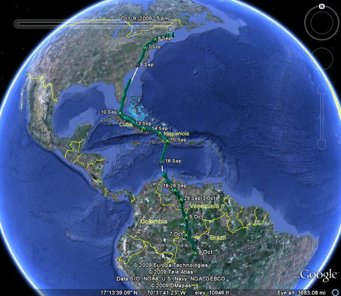 |
Travels so far. 5 Sep-31 Dec 09.
Mr. Hannah was the first adult to head
south. He left a day after Isabel, one of the Vineyard youngsters,
started her migration
due south out over the Atlantic. Mr. Hannah skipped the Vineyard and Long Island, making landfall in America in New Jersey. The winds were favorable the whole way down and he took advantage of them. On the 8th he broke with precedent, flying into the night while still over land. He was an hour north of Bald Head Island at 21:00 on the 8th. It's getting dark by then. An hour later he was over the mouth of the Cape Fear River, flying in the dark. He kept right on going out over the Georgia Bight, Florida bound. He took the usual route through Cuba and Hispaniola, leaving from Cabo Beato on the 15th. This is typically the launching pad for adult Ospreys on their way to South America. Juveniles don't know this short-cut and usually don't turn south until they run out of land in eastern Hispaniola. His travels south through Venezuela and Colombia and now into Brazil have been a bit unusual. Normally, adults don't linger so much en route to their winter quarters. On 9 Oct, Mr. Hannah settled down on the Jurua River in Amazonian Brazil. Green tents are evening roosts (couldn't resist) and the wavy lines on the 8th mark the last location for that day, out over the water. Scroll down for details of his movements. Jump to the beginning of migration. Skip to maps new since the last update (Dec 09). Skip to 2010 maps |
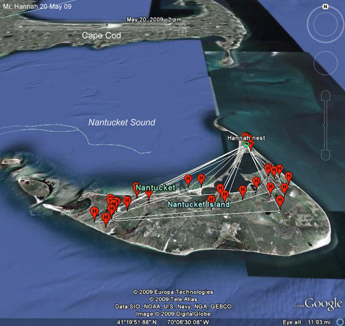 |
May
09.
Mr. Hannah has been fishing across
much of Nantucket. No signs that he's fishing offshore. Scroll down for more maps. |
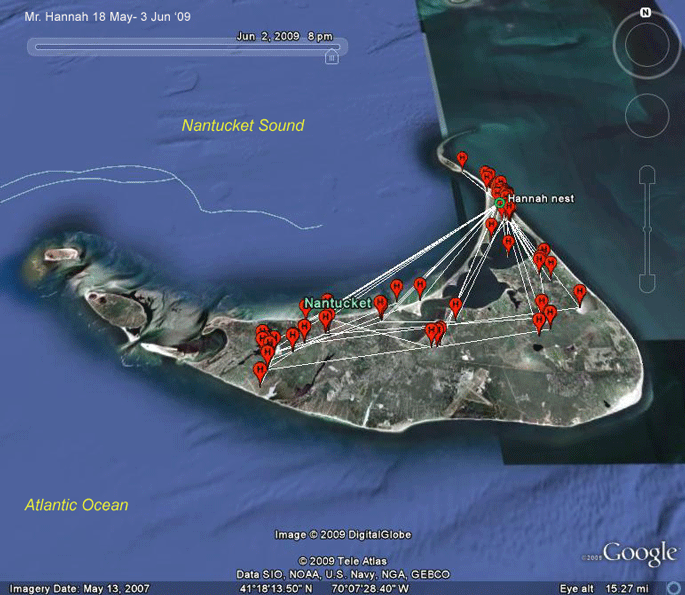 |
May 09. Mr. Hannah continues to hunt the same areas as seen in this map of his movements between 18 May and 2 June. |
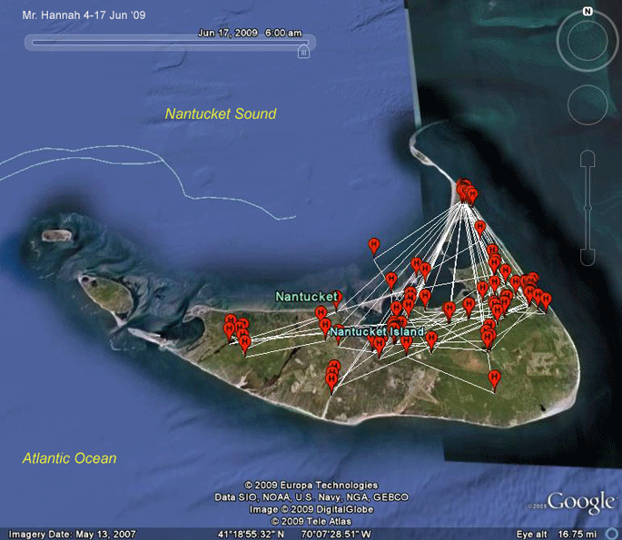 |
4-17 Jun 09. Mr. Hannah continues to hunt the same areas. He certainly doesn't have the flexibility that the Westport River birds do. |
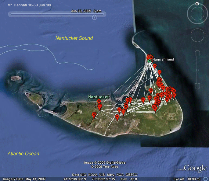 |
16-30 Jun 09. Mr. Hannah's nest failed sometime in June. This pair has not been very successful over the past few years. It seems that in this 2-week period he wasn't covering quite as much ground as when he was feeding young. |
 |
1-8 Jul 09. This map represents only a week's hunting, but it seems that just fishing for himself requires a lot less territory. |
 |
4-23 Jul 09. Mr. Hannah is covering less ground than when he was feeding young. He still spends time around the nest just to be sure no young upstarts get any ideas about taking over the territory. |
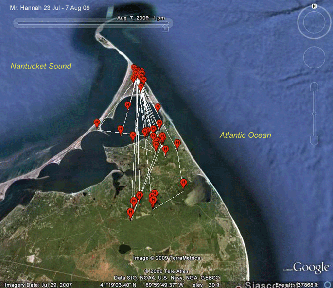 |
23 Jul-7 Aug 09. Pretty much the same picture as the previous two weeks. |
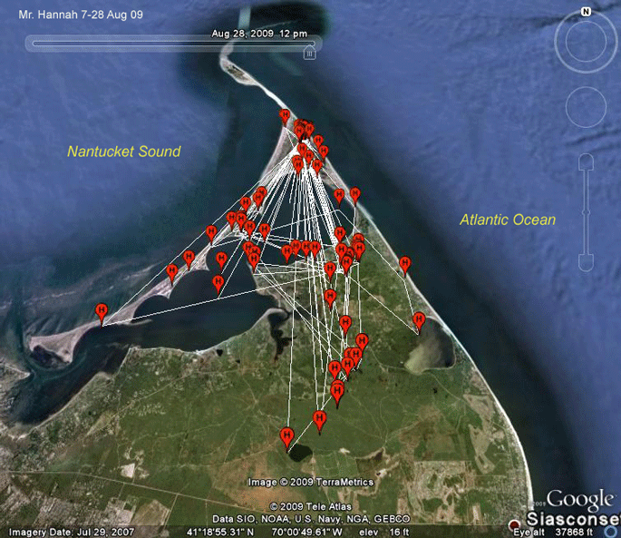 |
7-28 Aug 09. He's spread out a bit during this fortnight. |
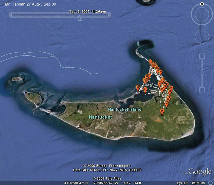 |
27 Aug-5 Sep 09. Back to basics. At this time, a big low pressure system was sitting off the coast with a cold front moving in. These conditions provide northeasterly winds, perfect for migration.... |
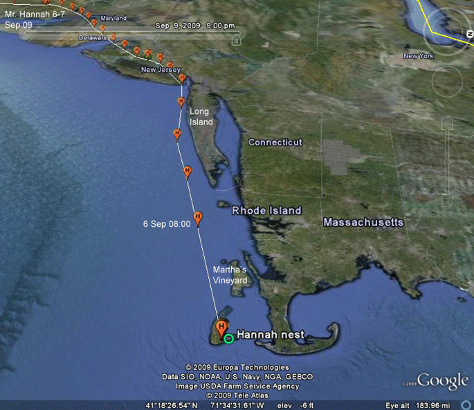 |
6-7 Sep 09.
Looking west in this view, we see that Mr. Hannah apparently woke up feeling like a change
of scenery and feeling a strong wind out of the northeast at his back. Couldn't
resist. He practically rocketed past the south shore of Long Island
(we're looking about due west here) travelling just under 40 mph (62 kph),
which is as fast as I remember any of our birds going. He was between 150m and 260m up--roughly 450-780 ft above sea level as he flew south of Long Island. He spent the night in central New Jersey. |
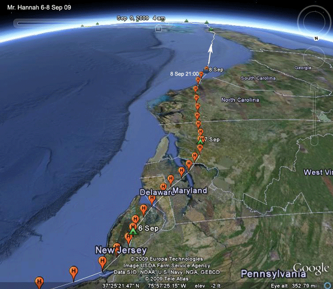 |
6-8 Sep 09.
(Looking south) Mr. Hannah just keeps on pushing
south. He's flown 771 mi (1,241 km) so far. He is unusual in that he kept flying while over land after the sunset. We've had very few birds do this. Most settle down around sunset if they can. It was dark when he hit the coast, but he kept right on flying, heading out over the Georgia Bight. |
 |
6-12 Sep 09. It took 20 hours for Mr. Hannah to cross 478 mi (770 km) of open water. He hit Florida around 15:30 and kept flying for a while. On to Cuba on the 10th. Weather must still be good, as he's moving right along without a day off. |
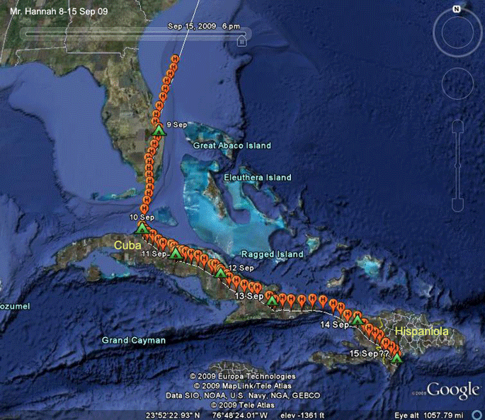 |
12-15 Sep 09.
Mr. Hannah does not rest. He is now on Cabo Beato, a
cape that sticks down off the island of Hispaniola. This is often a
launching pad for Ospreys heading to South America. There's little doubt
that that's where we'll find him when he next checks in. He has flown 2,275 mi. (3,661 km) in 10 days. An impressive start to his migration. So where's he going to go next? He knows, but we will find out only when he sets anchor down in S.A. somewhere. |
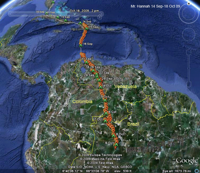 |
15 Sep-9 Oct 09.
The big picture here certainly shows Mr. Hannah on a
pretty directed path south through northern South America. It looks like he found his spot on the 9th. S.A. details below. |
 |
15-17 Sep 09. As expected, Mr. Hannah left Cabo Beato, taking the very shortest route (373 mi. or 600 km) across the Caribbean to South America. He landed on the Guajira Peninsula and kept right on going, crossing the Gulf of Venezuela and settling down to roost at a small reservoir 30 mi. (50 km) from the coast. |
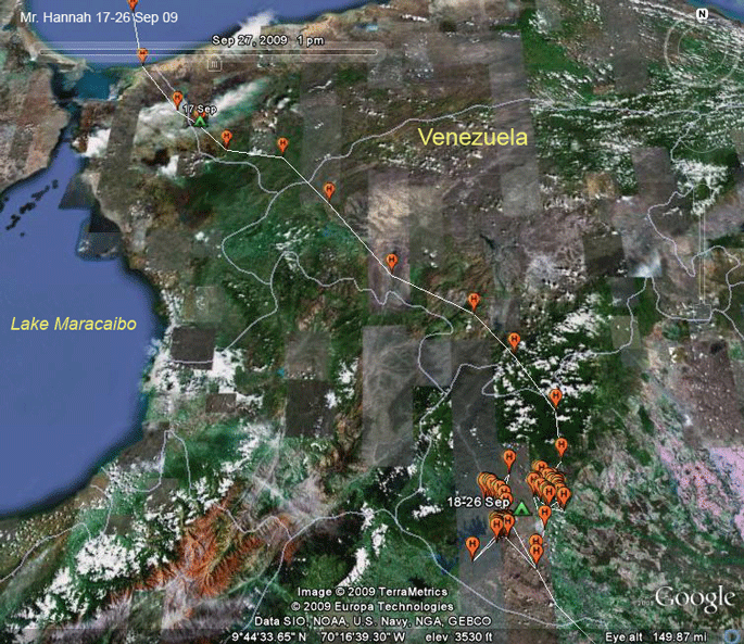 |
17-26 Sep 09.
Mr. Hannah moved over the coastal mountains on the
18th, following exactly the same path that Hudson would take through
this area about three weeks later. Mr. Hannah stopped for 8 days. It did rather look like he was going to settle down, but it was apparently just a major refueling stop. |
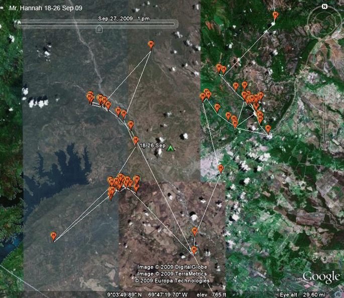 |
18-26 Sep 09. Despite the presence of a large reservoir nearby, Mr. Hannah spent all his time fishing along rivers before heading south. |
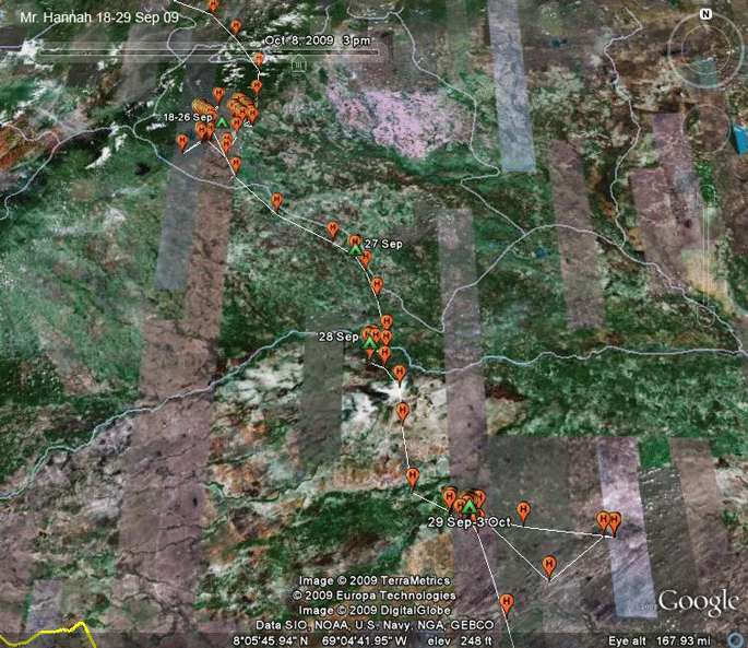 |
8-26 Sep 09. Mr. Hannah appears to be in no hurry heading south. He made another 4-day stop in Venezuela only three days after his week-long refueling stop. |
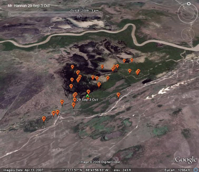 |
29 Sep-3 Oct 09. Mr. Hannah stopped for four days in this rather strange, marshy looking area in western Venezuela. |
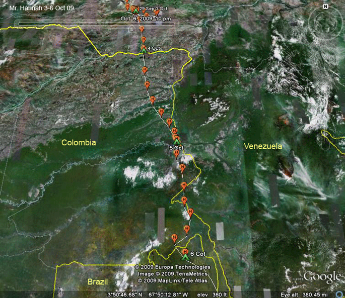 |
3-6 Oct 09. We have some momentum here. Mr. Hannah covered some ground. On the 5th he left the heavily man-dominated landscape and enter the Amazon. He crossed a lot of international boundaries on the 6th--out of Venezuela into Colombia, back into Venezuela, then back to Colombia before entering Brazil late in the afternoon of 6 Oct. |
 |
15 Sep 09. Mr. Hannah witnessed the ongoing deforestation of the Colombian rainforest here. This is the typical pattern for rainforest loss--when roads are cut into the forest, clear cutting inevitably follows. So, rather than forest loss occurring over a broad front, it usually happens as you see here--narrow strips are cleared, penetrating the forest. Eventually, these will expand until all the forest between is felled. |
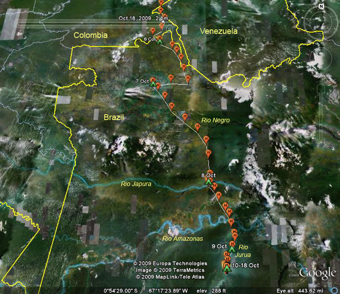 |
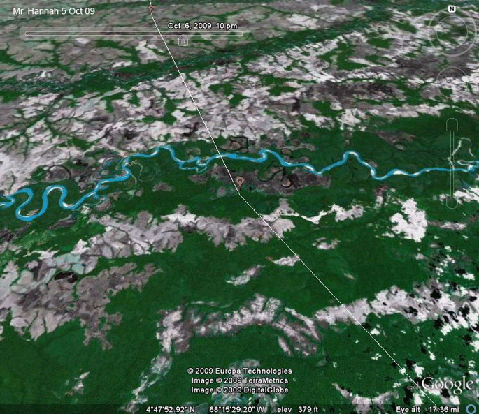
6-18 Oct 09.
Mr. Hannah is deep into the Brazilian Amazon here,
not too far from my old research area in Manaus. The jig to the west prior to roosting on the 7th is a bit strange. Hard to figure that one out. |
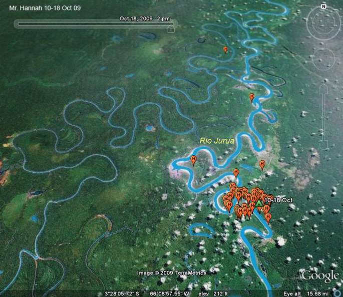 |
10-18 Oct 09.
Mr. Hannah seems to have set up shop here on the
Jurua River, one of the southern tributaries of the Amazon. This looks
like a bird that has found his way back to his winter home. The geology of the Amazon basin is really fascinating. The area drained by the Rio Jurua is all flat, only 20-60 meters above sea level, despite being over 1,000 miles from the mouth of the Amazon. The whole region is characterized by endlessly meandering rivers and ox-bow lakes. This is a false-color satellite image, meaning that the digital data from satellites have been artificially "tuned" so that most of the colors match reality--i.e. the forests are green. Sometimes this results in some colors being really off. The river that Mr. Hannah is hunting is not this blue. It is more a cafe-au-lait color, owing to a heavy sediment load. This sediment load makes fishing harder, as Ospreys can only see fish very close to the surface of the water. If this really is the end of the migration for Mr. Hannah, he flew 4,031 miles (6,487 km) from his nesting territory on Nantucket in 34 days, 22 of which were moving days, 12 were refueling stops. |
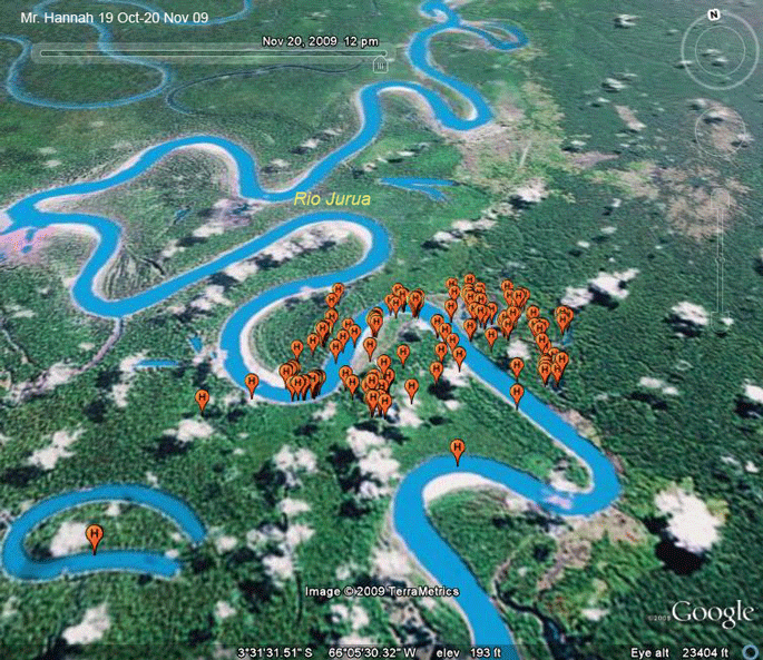 |
19 Oct-20 Nov 09. Mr. Hannah has settled down. I expect these maps to be very similar until he heads north in Feb or early Mar. |
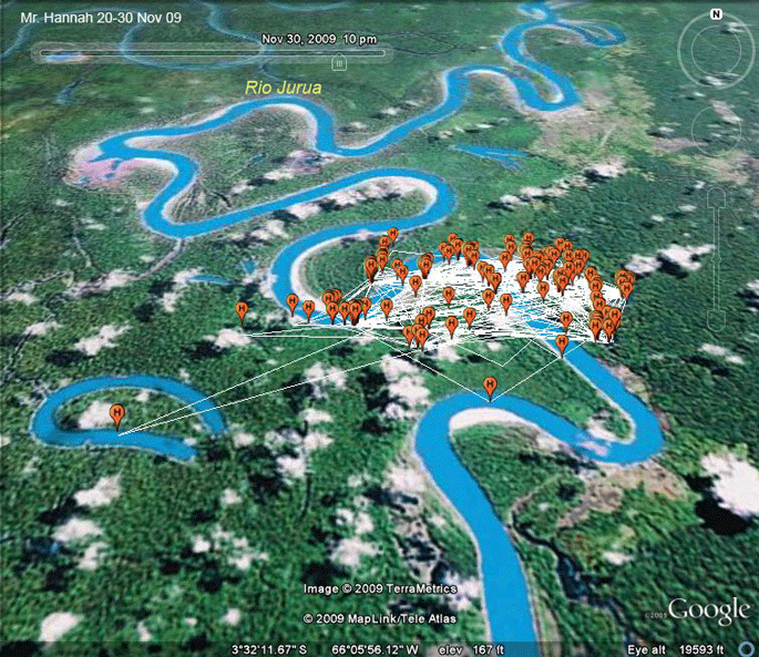 |
20-30 Nov 09. Mr. Hannah has clearly found his usual winter fishing ground. I've included the last 10 days of November in this map. Going forward, I'll just do monthly maps, unless he does something really surprising. |
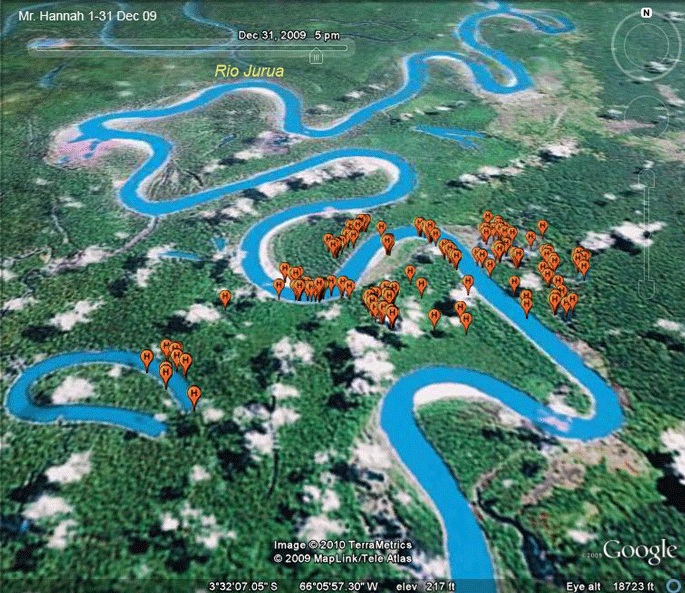 |
1-31 Dec 09. His locations for December, without the connecting paths are shown here. I expect the monthly maps will look just like this until he heads north, probably in February or early March. He seems to have enough fish here that his activity is restricted to an area just 2 miles (3.2 km) across! |
 |
1-31 Jan 10. Mr. Hannah should head north sometime in February. |
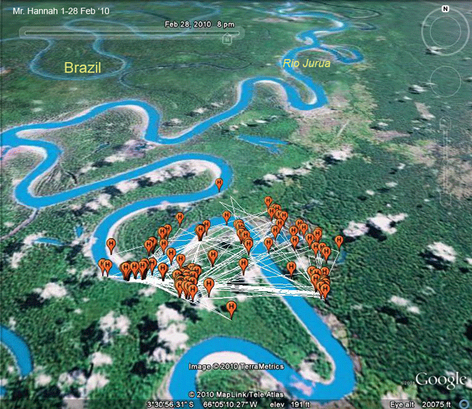 |
1-28 Feb '10. Another prediction gone awry. Oh, well, March for sure! Mr. Hannah is definitely a subscriber to the "if it ain't broke, don't fix it" school of migration management. |
Birds of Prey page -- Osprey main page -- Migration page -- Home Page