|
| |
Previous maps for Homer -- Scroll down for
more maps for Homer. '07 Maps for
Homer
'08 Maps for:
Claws --
Conomo
-- Duke--
Goody --
L.R. --
Meadow
-- Mittark --
Penelope
Birds
of Prey page -- Osprey
main page --
Migration08 -- Migration
page -- Home
Page
 |
26 Sept. 2008.
Homer left the
Vineyard on Sept 22. We don't have any fixes for him on the 23rd, so we
don't know what route he took to Delaware.
We have him roosting in northeastern Maryland on the
24th. Then on the 26th we got signals from a location 10 mi. southeast
of Fredericksburg, VA.
These were the last signals we received from Homer. We
don't know if he died or if his transmitter fell off.
Since we got the last signals, the transmitter's
battery has drained. Our only hope to find it is if the transmitter
changes its position somehow so that the solar panels are facing up. We
recovered Bunga's transmitter this way back in '04.
This was a tough bird to lose. He carried his
transmitter longer than any other bird we have studied and provided some
fascinating insights into the migration of juvenile Ospreys.
Scroll down for detailed maps. |
|
|
31 Jan 2008. Homer
has settled down right where he spent most of his first South American
sojourn.
|
|
|
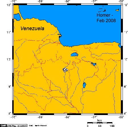
Feb-Mar 2008.
This map is for Feb, but the March
map would be the same. He has settled down at his reservoir.
|
|
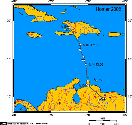 |
16 April 2008.
Homer is on his way home! He left headquarters at his
reservoir on the 12th and pushed off from Venezuela sometime in
the morning of the 14th. He made landfall on Hispaniola before dawn on the
15th. He spent the 16th in Haiti. 737 miles (1187 km) so far on the
Osprey-ometer.
Below is a satellite view of his
path out of Venezuela.
|
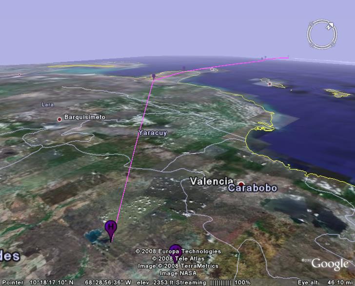 |
12-16 Apr 2008.
Homer leaves Venezuela behind. The three islands east
of his escape route are Aruba, Bonaire, and Curacao.
|
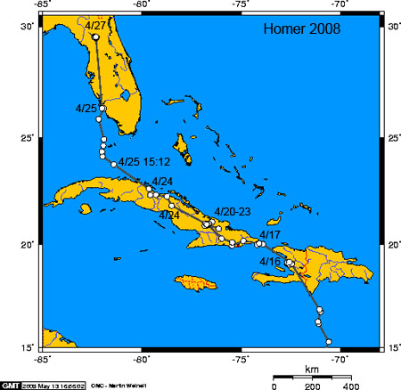 |
17-27 Apr 2008. Homer
took care of Cuba in a week. He does not seem to like
Miami. On his way south last fall he left the Florida coast north and Miami
and flew out over open water en route to Cuba. This time he made it to the
Keys on the 25th and hit the Florida coast at Sanibel Island. By the 27th he
was near Gainesville. At this point he had covered 1,822 miles (2,933 km).
Scroll down for an aerial view. |
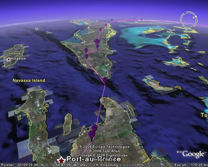 |
17-25 Apr 2008.
Here's his track leaving Haiti and crossing Cuba in
about a week. |
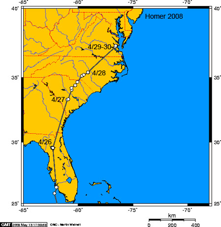 |
30
Apr 2008. Homer
took care of Georgia on the 27th and moved into North Carolina on the 28th,
passing close to Raleigh. By the 29th he was just north of Newport News, VA,
now 2,465 mi. (3969 km) into his return trip.
Scroll down for an aerial view of the next leg of his
trip. |
|
|
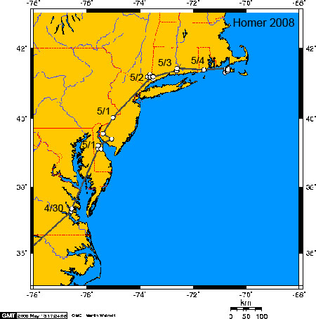
5 May 2008. Homer
is back at home. He saw the
sunrise in Delaware at his first location on this map for 1 May.
The second location for 1 May is just east
of Philadelphia the same day around 15:00. He probably moved further that
day, arriving at his 2 May location late on the 1st. He's just a
bit east of Armonk, NY, and may have passed over the Greenwich Audubon
Sanctuary (where I got my start as a young naturalist at their summer camp
almost 50 years ago) on the 3rd as he pressed on to the Connecticut River
(his location on 5/3 on the map). In Rhode
Island, he flew between Kingston and Charlestown around 09:00 on the 4th and
arrived on the Vineyard sometime later that day. The whole trip was 2,938
miles (4,730 km), which he covered in 23 days. His average distance covered
was 128 miles/day (206 km/day). Amazing.
Since his arrival he has been spending much of his time
around the freshwater mill ponds that were his base of operations all last
summer.
Scroll down for an aerial views of the last leg of his
journey.
|
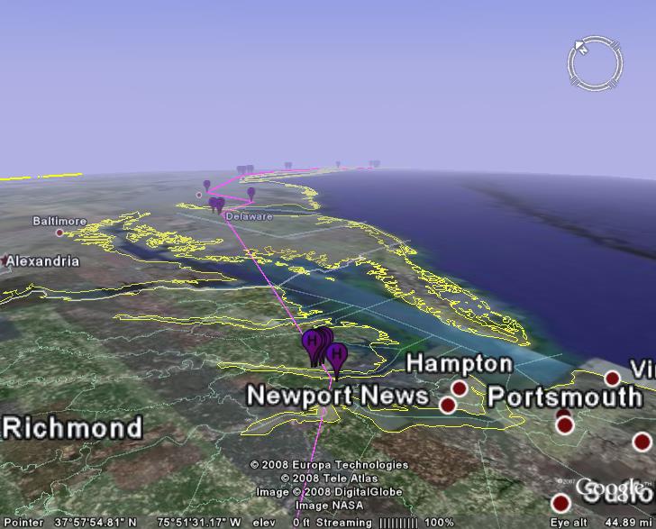 |
30
Apr 2008.
Homer
crossed Chesapeake Bay, home to perhaps 8,000 pairs of Ospreys according
to local specialist Bryan Watts, on Apr 30th and pushed on towards home,
arriving on the Vineyard on the 4th of May. |
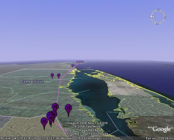 |
2-5 May 2008. Homer
made short work of Connecticut and Rhode Island, arriving on his natal
turf on the 4th. |
|
|
31 May 2008. Homer
settled right down at the Crocker Pond at the north end of North Rd. This
was his base of operations last summer as well. There was a nesting pair of
Ospreys here back in the 50s and perhaps early 60s. They left the area when
their nest tree fell. This would be a great spot for a new pole!
He's definitely an Up-Island bird. |
|
|
30
June 2008. I'll post
monthly maps as the summer progresses. We don't expect much new from our
oldest tagged bird. Next year he should be ready to nest.
Looks like he's been hunting in Vineyard Sound, perhaps
visiting the Elizabeth Islands and Katama, although interpreting the data
from non-GPS transmitters at this scale is a bit risky. The cluster of
points around Crocker Pond is certainly real. |
 |
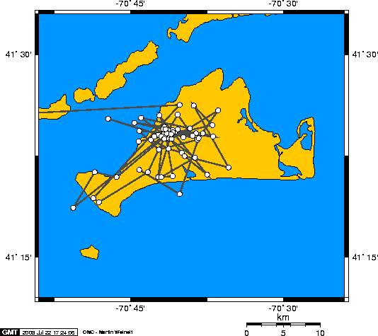
July 2008.
These are the two most accurate class satellite
locations for Homer in July. There's one high-quality location 18 mi.
(29 km) west of the Island, which is suspect and not shown here.
Below there's a close-up of the ponds that Homer calls home. |
 |
|
 |
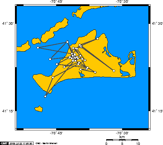
Sept 2008.
Homer shifted his base of operations from Crocker
Pond to Chilmark.
The central cluster of points is puzzling. There is no
pond there, so I'm not sure why he spent so much time there. Mittark
also spent quite a bit of time here prior to leaving on his migration.
This may just be some high ground where there's a good
view of Menensha Pond.
Homer left the Island on the morning of the 22nd. |
Birds
of Prey page -- Osprey
main page -- Migration
page -- Home
Page
|