Mr. Hannah - 2010
'09 maps for:
Bea
--
Buck -- Caley --
Claws --
Conomo --
Hix --
Hudson 09 -- Isabel --
Katy -- L.R. --
Moffet --
Mr. Hannah --
Ozzie --
Penelope
--
Rafael
2010 maps for: Belle -- Buck --
Gunny --
Hudson --
Mr. Hannah --
Neale --
North Fork Bob
--
Penelope --
Sanford
-- Sr. Bones --
Thatch
2011 maps:
Belle --
Buck --
Henrietta --
Katbird
-- North Fork Bob --
Pemi --
Saco --
Sanford --
Sr. Bones --
Snowy --
Thatch -- Tucker
2012 maps: Art --
Belle --
Bridger --
Chip --
Cutch --
Jill -- North Fork Bob --
Rammie --
Snowy --
Sr. Bones -- Thatch
2013 maps: Art --
Belle --
Bridger --
North Fork Bob --
Rammie --
Snowy --
Sr. Bones
Osprey
main page --
Migration
page --
Migration09 --
Migration10 --
Migration 11 --
Migration 12 --
Migration 13 -- Home
Page
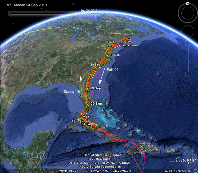 |
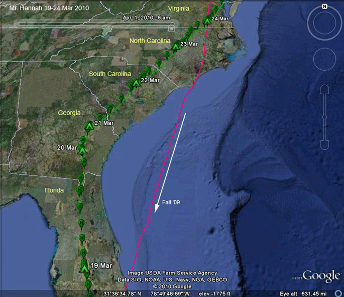
Heading south again.
Mr. Hannah left Nantucket on the 15th,
nine days later than in 2009. Seven days later he was in Cuba. On this map I have plotted the other two trips we have followed since we tagged him in the spring of 2009. Scroll down for more detailed maps. Jump to his northbound trip in the spring of this year Jump to the 2010 breeding season movements. Jump to the start of this year's migration south. |
|
 |
Heading north.
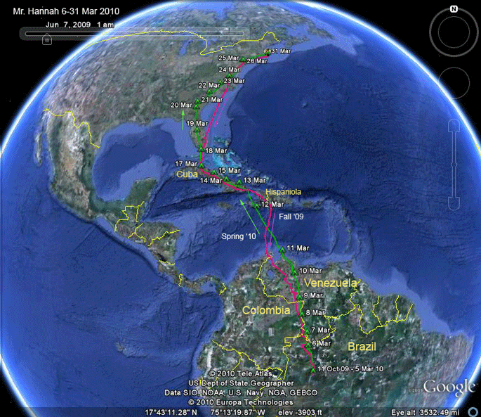
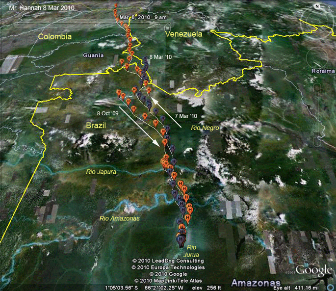
In 2009, Mr. Hannah was the first
adult to head south. Fittingly, he was the first to head north in 2010 On 9 Oct. 2009, Mr. Hannah settled down on the Jurua River in Amazonian Brazil. He spent the next 5 months in an apparently very fishy spot. The area he covered during his whole time on the Jurua was about 3 square miles (260 hectares)! He started north on the 5th of March and arrived back on Nantucket 27 days later. The trip south (in pink) was 3,801 mi (6,487 km), and the trip north was 3,793 mi (6,474 km). Scroll down for details of his movements. Jump to this year's breeding season on Nantucket. Back to his 2009 maps |
|
 |
5-7 Mar '10.
Mr. Hannah started the long trek home
on 5 March. He's not exactly retracing his route south (indicated here
by the orange symbols). We expect to see as he heads north a much more
directed trip, with less dilly-dallying along the way. This is a bird on a mission--he has to get back to his territory and reclaim it before any whipper-snapper youngsters get ideas about muscling in on his nest. |
|
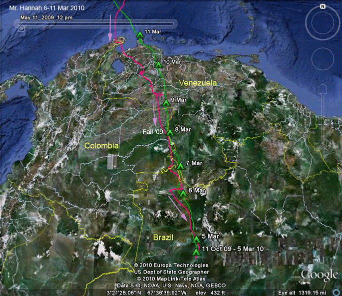 |
5-11 Mar '10.
Mr. Hannah hit the north coast of
Venezuela about 1,100 miles (1,770 km) north of his winter hangout in
Brazil. This took him 7 days. Green tents are his roost locations-where he stopped migrating for that day. |
|
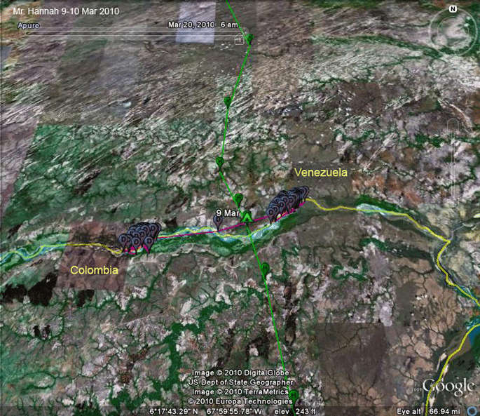 |
9-10 Mar '10. Mr. Hannah camped out on the Meta River between Colombia and Venezuela, right where Hudson spent the winter (D symbols). Hudson had already left the area--just 2 days before. | |
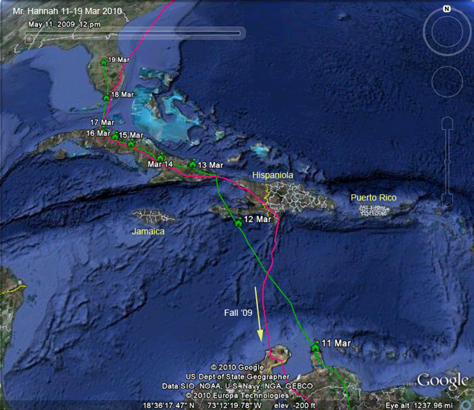 |
12-19 Mar '10. Mr. Hannah crossed the Caribbean Sea on the 12th and pushed on to Cuba. He slowed down a bit as he got to Cuba's north shore. He made it to the Florida Keys on the 18th, and then moved on to Central Florida on the 19th. | |
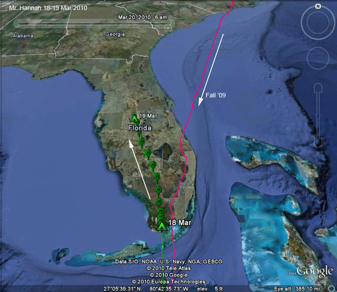 |
18-19 Mar '10. Mr. Hannah crossed about half of Florida on the 19th, roosting in Polk County. | |
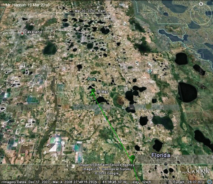 |
19 Mar '10. Mr. Hannah spent the night of the 19th near the most appropriately named Lakeland, FL. | |
 |
19-24 Mar '10. Mr. Hannah moved steadily through the southeast for five days. | |
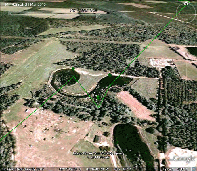 |
21 Mar '10. This was either a roost on the 21st or a stop for a late afternoon snack. The data are a bit ambiguous. | |
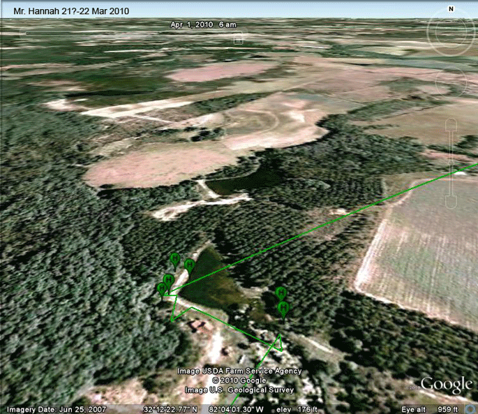 |
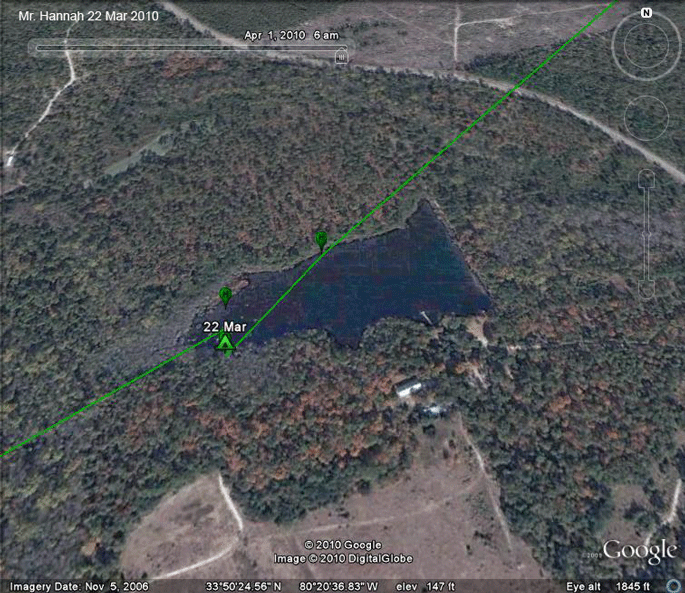
22 Mar '10.
The first data for Mr. Hannah on the
22nd and fixes through 11:00 were around this little pond in eastern
Georgia near the town of Collins. He usually starts his day's travels around 09:00, so either the weather was not conducive to migrating in the morning, or he wanted to catch a fish before heading on. |
|
 |
22 Mar '10. Mr. Hannah spent the night at this pond just south of Sumter, SC. | |
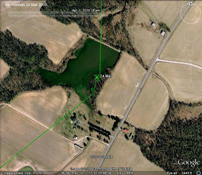 |
24 Mar '10. Mr. Hannah continued his new state every day trip north roosting at this pond in southern Virginia (near Newsoms). The roost site in NC was the first in a while not at a small man-made pond. | |
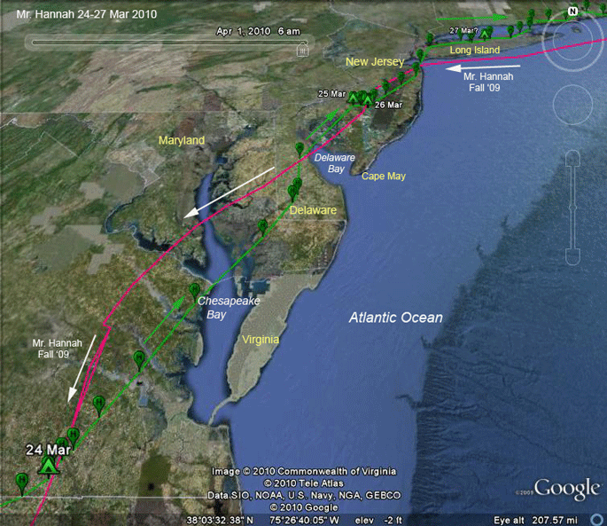 |
24-27 Mar '10.
Mr. Hannah was in 4 states on the 24th
(VA, MD, DE, and NJ). The straight-line distance between roosts on the
24th and 25th was 255 mi. (411 km). The 26th was not a moving day, probably due to bad weather. On the 27th he was moving again and made it to Long Island. |
|
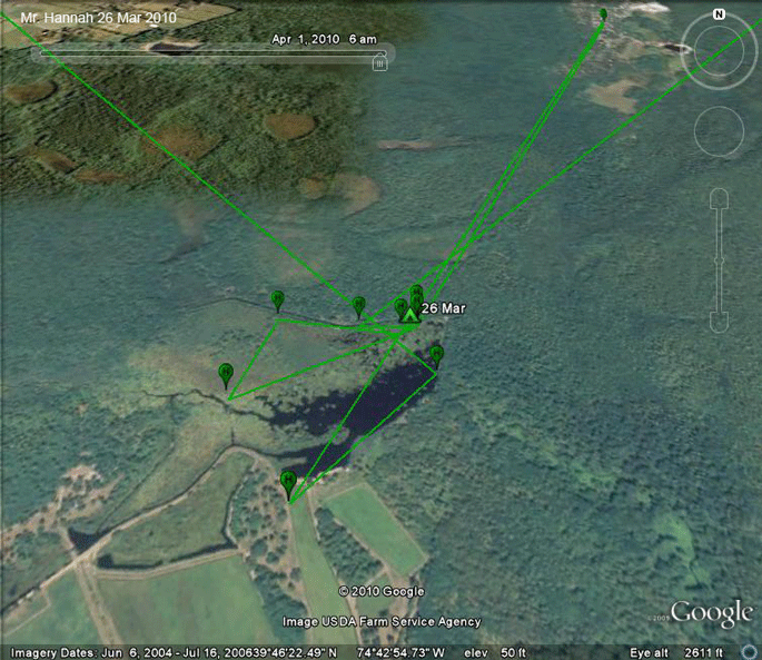 |
26 Mar '10. Mr. Hannah spent the day fueling up around this pond in the New Jersey Pine Barrens 25 mi. east of Philadelphia. | |
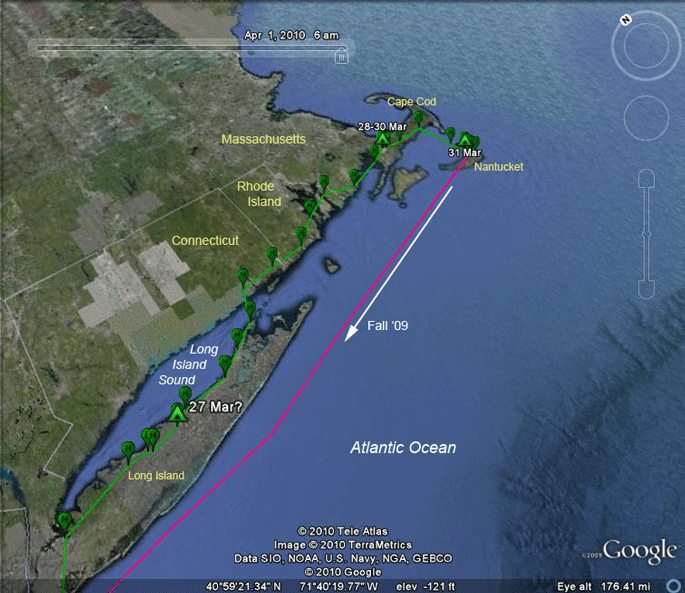 |
27-31 Mar '10.
We're not sure where Mr. Hannah spent
the night on Long Island's north shore, but on the 28th he crossed Long
Island Sound to add Connecticut to his itinerary, took care of Rhode
Island in about 3 hours and finally settled down for the night on Cape
Cod. |
|
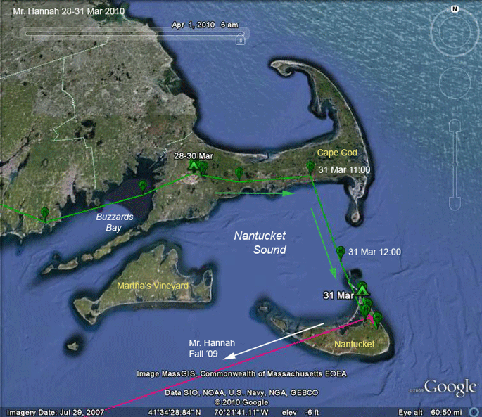 |
27-31 Mar '10. Mr. Hannah arrived on the Cape and hunkered down for a couple of days near the Otis Air National Guard base. He was waiting out a torrential rainstorm that was pummeling southern New England. | |
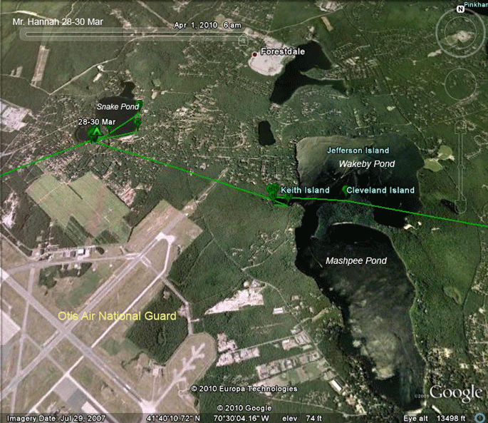 |
28-30 Mar '10. Mr. Hannah spent the 29th and 30th around Snake Pond just north of the Otis Air National Guard station in western Cape Cod. On the 31st he spent about 5 hours around Wakeby and Mashpee Ponds before heading home to Nantucket. | |
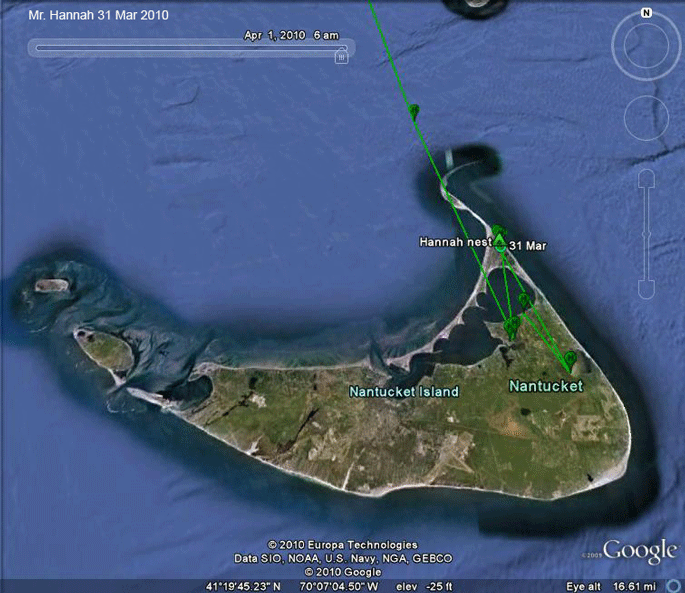 |
31 Mar '10.
Homecoming! Mr. Hannah arrived on
Nantucket just after 12:00 on the 31st, exactly (coincidentally he
started and ended migrating at noon) 27 days later. Of those 27 days, he
was actively migrating on 24. He covered 3,793 mi. (6104 km), averaging 158 mi (254 km)/day of migration. Rather remarkably, despite different routes south and north (scroll up to the first map), the distance he covered was only 8 miles longer going south than coming home this spring. Heading south, he covered the distance in a total of 34 days, with 12 days of resting, waiting for weather, or fishing, and 22 days on the move. |
|
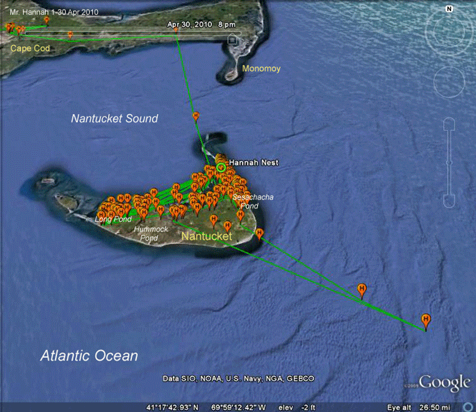 |
1-30 Apr '10.
Mr. Hannah has been hitting the usual
fishing holes and made one trip way off shore. Mrs. Hannah laid four eggs sometime during the month. |
|
 |
1-7 May '10. Pretty easy fishing at the moment, just feeding himself and the Mrs. | |
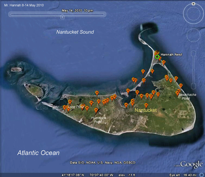 |
8-14 May '10. More of the same. | |
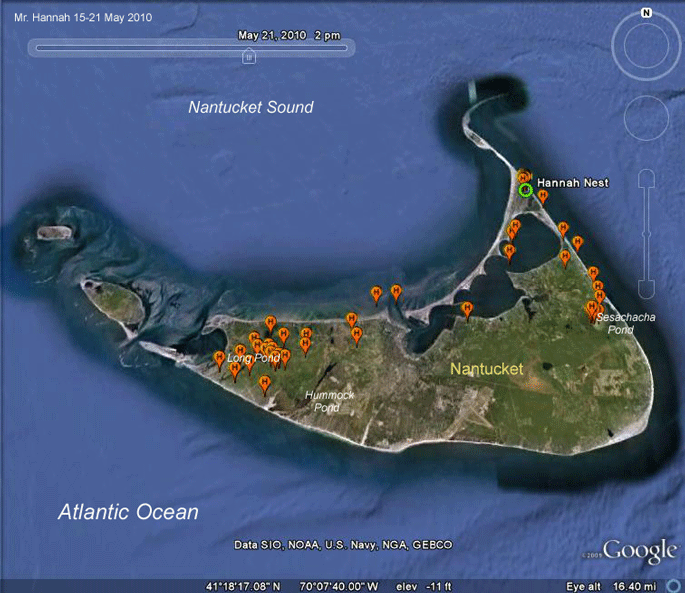 |
15-21 May '10. The fishing seems to be good at Sesachacha and Long Ponds. Or at least that's where most of his time is being spent. | |
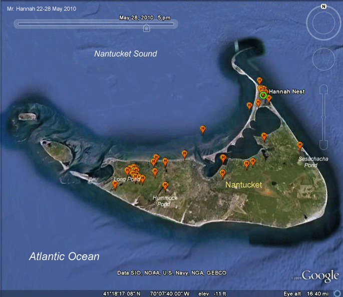 |
22-28 May '10. Long Pond is the place to be this week. | |
 |
29 May-5 June '10.
Sort of all over the place this month.
The cluster of points northwest of Sesachacha Pond seem to be a bit of
woods he likes to rest in during the day. We're not sure exactly when it happened, but sometime in June Mr. Hannah's nest failed, which means he couldn't catch enough fish to feed his young and they starved. This nest has traditionally been a poor producer, reminding us that not every individual that makes it into the breeding population is going to contribute to the next generation. In fact, whenever long-term studies of a sizable population of birds have been conducted, we almost always find that just a few individuals are contributing most of the young in that area. |
|
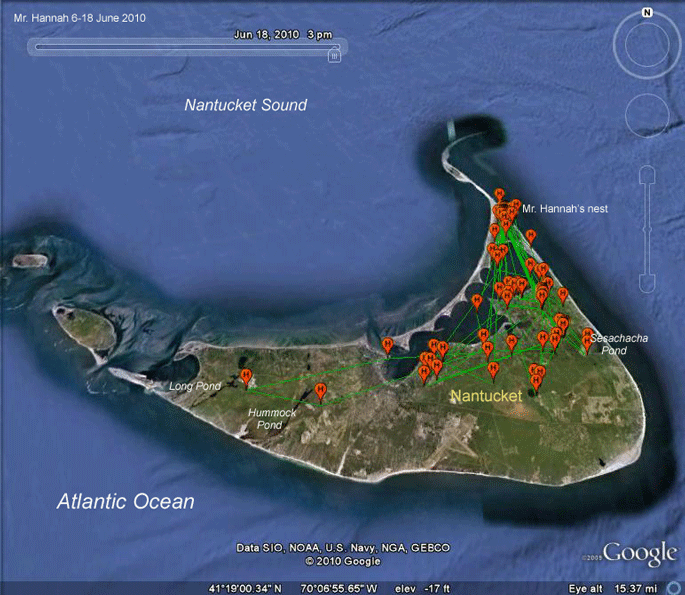 |
6-18 June '10. Staying pretty close to home. | |
 |
19-27 June '10. Even more so. It's really interesting to see this behavior in contrast to Sr. Bones, who, when faced with the same lack of fish issues that presumably caused both nests to fail, has opted for "commuting." Sr. Bones is traveling to the Cape and Martha's Vineyard in search of better fishing, while checking back in at his nest every once in a while to make sure no one gets any ideas about taking it over. | |
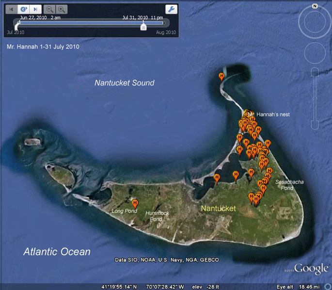 |
1-31 July '10. Just on cruise control until the days start getting shorter. | |
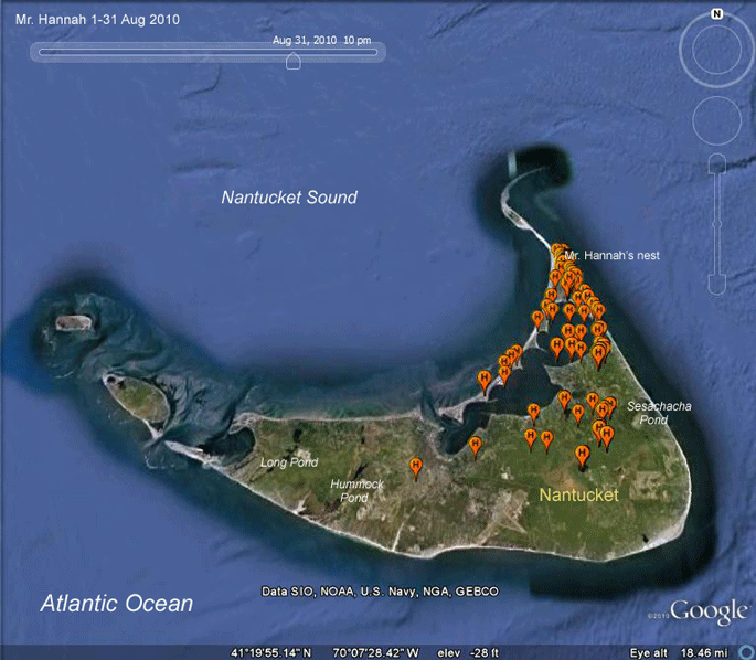 |
1-31 Aug '10. Ditto. | |
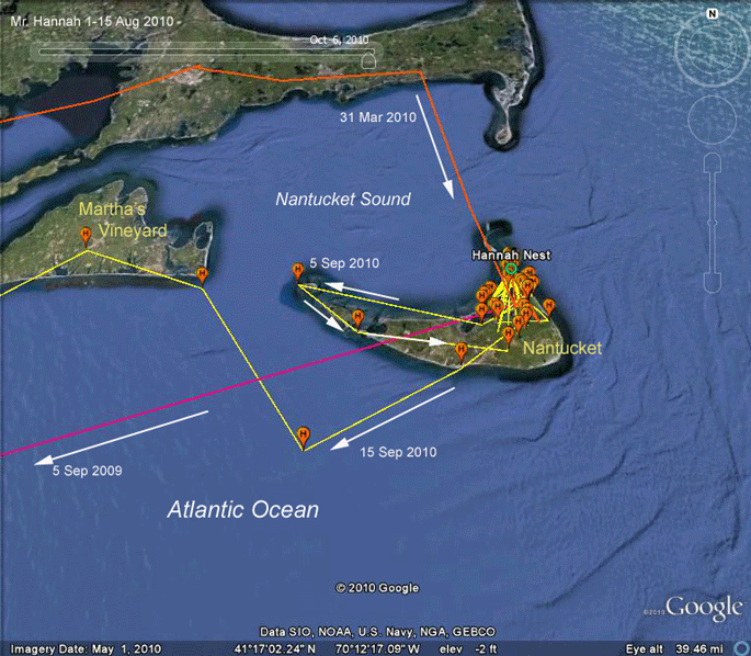 |
1-15 Sep '10.
Finally. Mr. Hannah's tracks from the
fall of '09 and spring of this year will show up on most of the
following maps. Pink is his first trip south with our transmitter.
Orange will be his return in spring of this year. Last year he left on the 5th. This year he thought about leaving in the same day but when he got to Tuckernuck (the western tip of Nantucket) he changed his mind. (Probably forgot something.) Five days later he began his migration. The first leg was out over the Atlantic, heading for New Jersey, same as last year. This time around, however, he changed his mind and went north up to Martha's Vineyard. He left Nantucket at 11AM. |
|
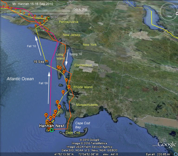 |
15-16 Sep '10. MLooking over Mr. Hannah's shoulder as he heads south for our second migration. It's unusual for one of our tagged Ospreys to miss all or most of Long Island or Connecticut. Usually, they stay over land through this initial stage of the trip. | |
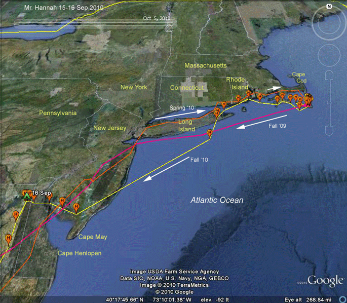 |
15-16 Sep '10. Same travel-more conventional perspective. 386 mi (621 km) on the first 2 days. | |
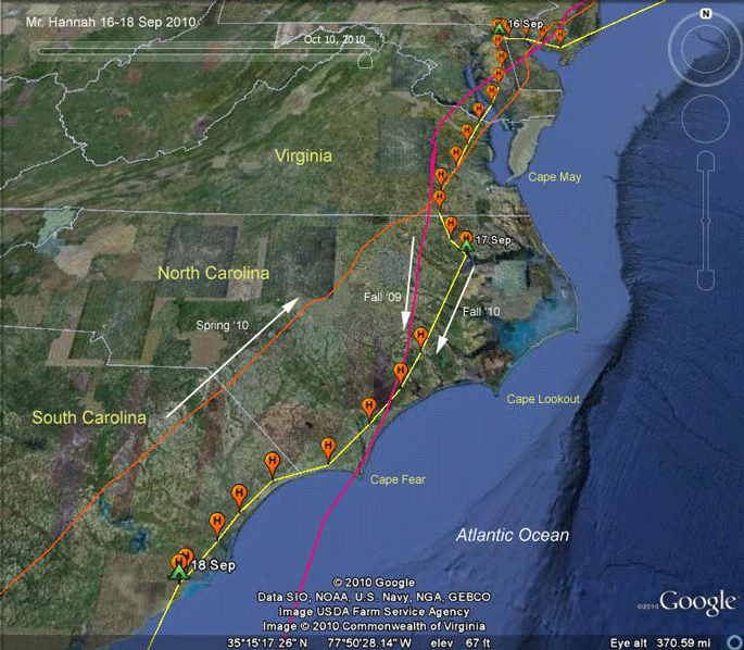 |
16-18 Sep '10.
On the 17th he spent the night on the
shores of the Chowan River just a bit north of the mouth of Albemarle
Sound in northeastern North Carolina. On the 18th he camped about 20 miles north of Charleston, South Carolina. He's on a roll-the weather is good and he's an Osprey on a mission. |
|
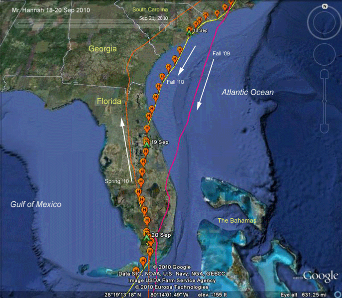 |
18-20 Sep '10. On the 19th he bit off a bit of the Georgia Bight (couldn't resist that one) and made it to Florida around 4:30PM. He roosted just east of Kissimmee, Florida on the 19th and pushed on south to the Everglades on the 20th. | |
 |
20 Sep-2 Oct '10.
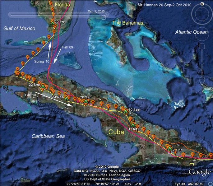
I suspect that when we check the
winds, we'll find a strong easterly wind was blowing when he crossed the
Florida Straight en route to Cuba. Once on land, he worked his way down Cuba, staging for a while in central Cuba near Sergio Gonzalez waiting for better weather. Most of this time he was hunting rivers, rather than the several reservoirs nearby. By the 2nd he had covered 2,138 miles (3441 km). Not counting staging days, he was averaging 164 miles (265 km) per day on the move. |
|
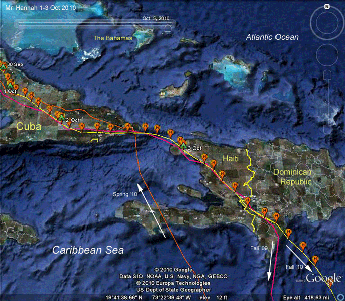 |
2-4 Oct '10.
Pretty straightforward here. We're not
sure exactly where he roosted on the 3rd, but he was closely following
the same track he took in the fall of '09. The differences in his departure direction almost certainly is due to the wind direction when he left the D.R. At this stage of the migration (mid-way, more or less), the birds "go with the flow." They're obviously not making a conscious decision about this, but because their navigational abilities are what they are, they do not have to follow a memorized route to their destination. Therefore, they don't have to waste energy fighting the wind. |
|
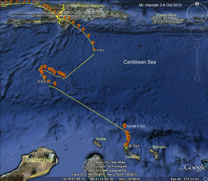 |
3-6 Oct 2010.
Here's what the GPS data looks like
for Mr. Hannah crossing the Caribbean. Pretty weird. So, what happened? First, he took off from his roost somewhere in Haiti (no good fix for the end of the 3rd so we don't know exactly where he spent the night) before 10AM. Around 4:40PM he headed out over the Caribbean. He may have taken a bit of a breather (about 30 min) between 3 and 4 PM. Once he got going again, he was clipping along at an average of 28 mph (45 kph). Then his GPS unit shut down for the evening at 10PM. When his GPS turned back on on the 5th, he was pretty far off his course of the evening before and heading in the wrong direction, at only about 10 mph (16 kph). He had gone only 111 mi (179 km) in 12 hours while the GPS was off. |
|
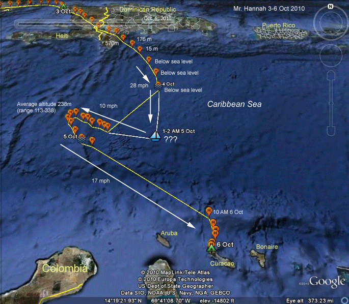 |
3-6 Oct 2010.
The data are really confusing. I have
a scenario that fits perfectly with everything except the altitude data
from the GPS. Scroll down for a possible explanation (if we ignore the altitudes). |
|
|
When we get his
signal back on the 5th, he appears to be on a ship (except it must be a
very tall ship-the average altitude from his GPS during this time was
238 m (780 ft)). We think he was on a ship because he's only going about
10 mph, which is too slow for an Osprey to be flying, and in the wrong
direction (see Penelope's travels after leaving the D.R. this year). The line connecting the last point on the 4th with the 1st on 5 Oct does not mean that he followed that path, only that those are two consecutive GPS fixes from his transmitter. To figure out where he may have gotten on the ship (if that's what he did), I extended the route he was taking south and worked the track on the 5th backwards. The two lines meet (where I have the sailboat icon on the map) at around 1-2 AM just where he would have been if he kept on flying on the same course and speed, and just where the ship would have been at that time. (I don't think he landed on a sailboat, but that was the best icon Google Earth had to offer.) So that makes great sense, if we believe that 12 consecutive GPS altitude calculations could be that far off. But then what happened when he turns back to the southeast? Here I can't come up with a really convincing narrative. It sort of looks like he talked the captain of the ship into turning around and taking him to Curasao. That fantasy aside, it would appear that he jumped ship and, correcting for the displacement caused by his hitch-hiking, he headed off towards his original destination. For the rest of his journey he averaged 17 mph from when he turned back to the southeast until he got to Curasao. That's a bit slow, but just about what North Fork Bob did during his crossing on the 8th. Could the wind have switched around sometime late on the 4th so much that, on the first part of the 5th he was flying, say, 25 mph into a 35 mph headwind, and thus actually backing up at 10 mph relative to the ground? That seems pretty far-fetched, but would fit the data. If the wind slacked off, the same flight effort would see him making forward progress towards his destination. To really understand this, we're going to have to get the weather data for these days. All told, it was just shy of 46 hours after he left the D.R. that he found dry land on Curasao. That's not a record for one of our birds over open water. Several of the juveniles have flown between 50 and 60 hours non-stop from Martha's Vineyard to the Bahamas. |
||
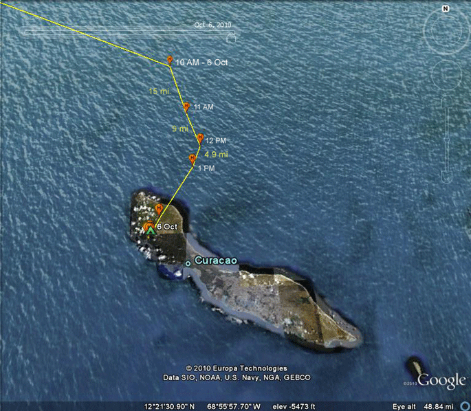 |
6 Oct 2010 Coming into Curasao, Mr. Hannah really slows down. Between 11 AM and 12 PM he only moved 9 miles. Then between noon and 1 PM he only made it about 5 miles closer to land. That's just a fast walk for a human, and an Osprey cannot fly that slowly, so he must have perched on something out there (assuming he wasn't still on a ship). In fact, the 12 PM location is right at sea level, so that fits. |
|
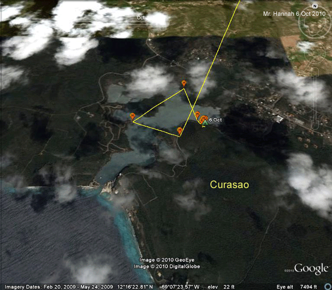 |
6 Oct 2010 Finally! Mr. Hannah does something that makes sense. He stopped at a big bay on Curasao for some much needed rest and refueling. |
|
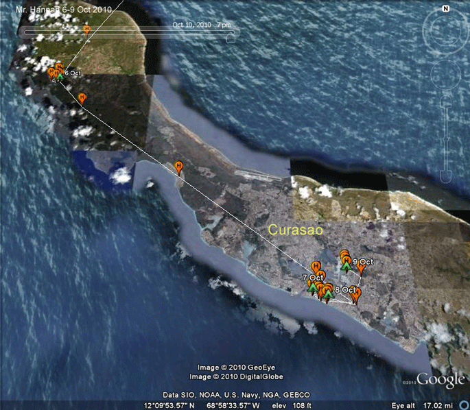 |
6-9 Oct 2010 All looked well here, but it appears we have lost another Osprey. Mr. Hannah moved down the island and spent the 8th and 9th pretty much in downtown Curasao. His last map follows. |
|
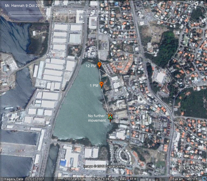 |
9 Oct 2010 This one is pretty mysterious. Mr. Hannah survived some very strange and perhaps exhausting travels over the Caribbean, but seemed to have been moving around in likely looking fishing spots, so I didn't expect to have him drop off the map like this. For the blindly optimistic, (where I find myself too often), we can hope that the transmitter harness broke and he dropped the transmitter. We'll probably have to wait until spring to see if a banded bird shows up at Mr. Hannah's nest. |
|
Birds of Prey page -- Osprey main page -- Migration page -- Home Page