Belle - 2010
'09 maps for:
Bea
--
Buck -- Caley --
Claws --
Conomo --
Hix --
Hudson 09 -- Isabel --
Katy -- L.R. --
Moffet --
Mr. Hannah --
Ozzie --
Penelope
--
Rafael
2010 maps for: Belle -- Buck --
Gunny --
Hudson --
Mr. Hannah --
Neale --
North Fork Bob
--
Penelope --
Sanford
-- Sr. Bones --
Thatch
2011 maps:
Belle --
Buck --
Henrietta --
Katbird
-- North Fork Bob --
Pemi --
Saco --
Sanford --
Sr. Bones --
Snowy --
Thatch -- Tucker
2012 maps: Art --
Belle --
Bridger --
Chip --
Cutch --
Jill -- North Fork Bob --
Rammie --
Snowy --
Sr. Bones -- Thatch
2013 maps: Art --
Belle --
Bridger --
North Fork Bob --
Rammie --
Snowy --
Sr. Bones
Osprey
main page --
Migration
page --
Migration09 --
Migration10 --
Migration 11 --
Migration 12 --
Migration 13 -- Home
Page
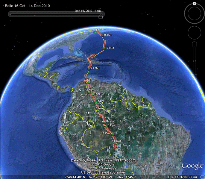 |
16 Oct-14 Dec 2010. Belle got off to a late-ish start for her migration,
but made up for the delay by rocketing down to Venezeula in only 7 days.
A quick check of the records suggests this is the record for any of our
birds. After a couple of weeks on the shores of Lake Maracaibo in Venezuela, just an hour's flight north of Buck's wintering grounds, Belle took off on the 9th of November and 8 days later was south of the Amazon in northwestern Brazil. After 18 days there, she took off again and is now the furthest south of any of our birds ever, in the Brazilian state of Rondonia. Scroll down for detailed maps of Belle's summer movements or- The start of migration. South of the Amazon |
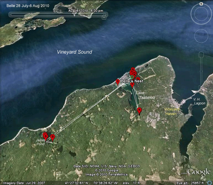 |
The first few days: 28 July-1 Aug 2010. Belle's mostly sticking near her nest, but she has made a couple of forays out to James Pond, where we see lots of Ospreys go to fish in the mid-to-late summer. |
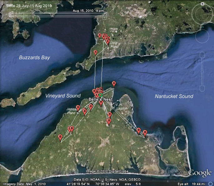 |
28 July-15 Aug 2010. Belle is beginning to explore the world around her. She flew over to "America," as the mainland is known on Martha's Vineyard, on the 13th and spent two nights at Long Pond just north of Falmouth. She flew back home early on the 15th. |
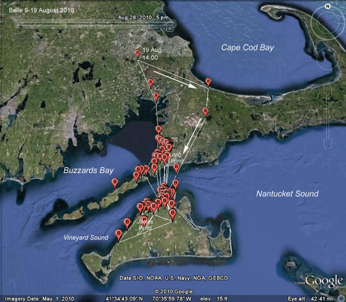 |
9-19 Aug 2010. Belle continues to explore. She spent quite a bit of time at Long Pond, north of Falmouth, and did some fishing over on the Elizabeth Islands. She's back on the Vineyard now (19 Aug). |
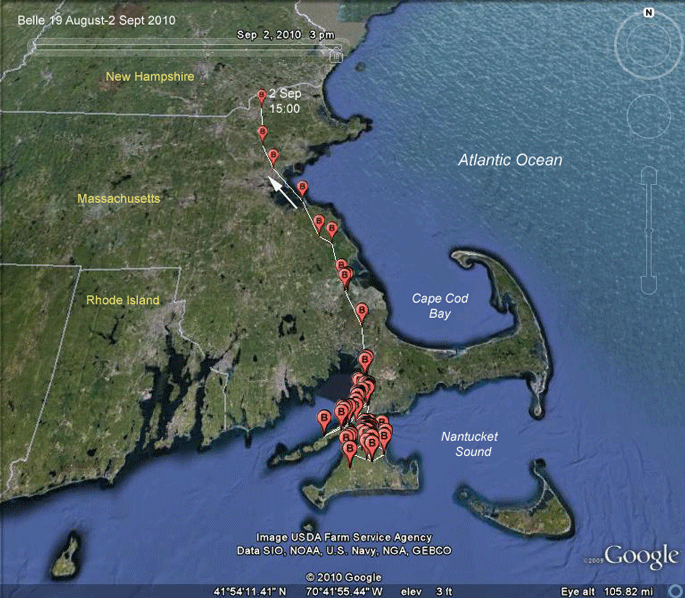 |
19 Aug-2 Sept 2010. Like her sister Meadow ('08), Belle's first major move off Martha's Vineyard was in the "wrong" direction (Meadow followed this general route all the way to Lake Superior!). This is only the wrong direction if we consider this movement migration. In fact, this movement is more appropriately termed dispersal. About half of our young Ospreys have moved away from their natal areas prior to beginning their true migration. These trips add to the bird's knowledge of their world, especially where the good fishing spots are. |
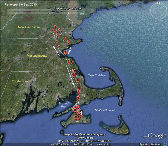 |
2-6 Sept 2010. Belle's trip north was just a bluff. She continued a bit further north into New Hampshire and then hustled back to Martha's Vineyard. |
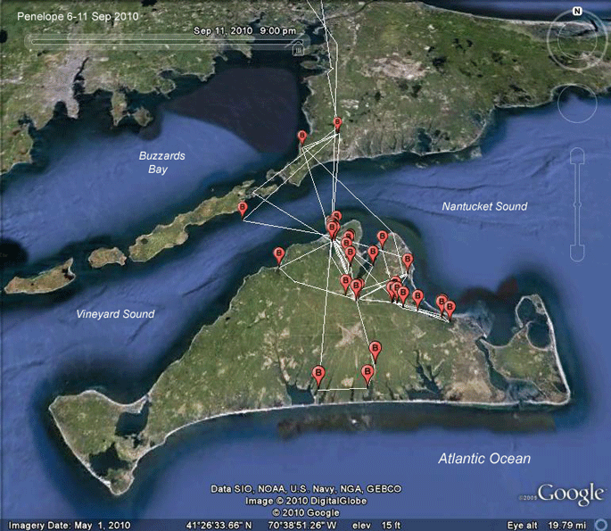 |
6-11 Sept 2010. Belle is still basing her operations at her nest. She made a 4-hour junket over to the Elizabeth Islands and Cape Cod around mid-day on the 7th, stopping at Long Pond north of Falmouth, where she has done a lot of fishing. On the Vineyard, she's been down to the great ponds along the south shore and spent a lot of time at Sengekontacket Pond. |
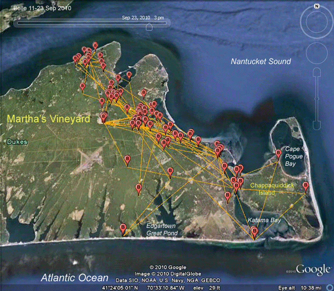 |
11-23 Sept 2010. Belle is no longer basing her operations at her nest, but she does check in up there every once in a while. |
 |
1 Sept 2010. Belle is no longer visiting her nest on the shores of Lake Tashmoo. The Head of the Lagoon is sure getting a lot of attention from her. Anyone on the Vineyard know what's keeping her busy up there? |
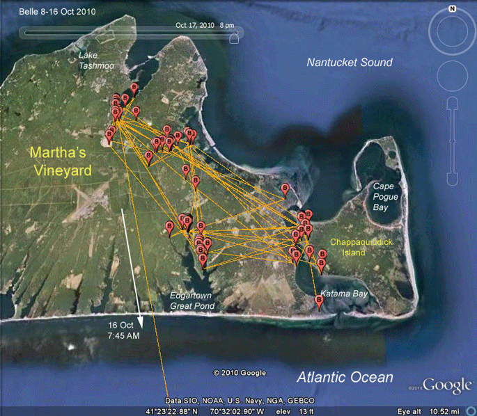 |
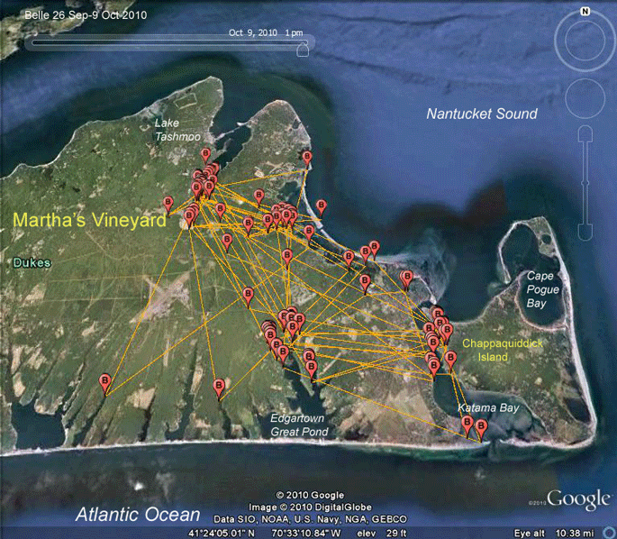
8-16 Oct 2010. Belle had four main fishing areas while she was
fueling up for the long trip ahead--the Head of the Lagoon, Major's
Cove, Edgartown Great Pond, and upper Katama Bay. She took off pretty early in the day (by Osprey migration standards) on the 16th, probably leaving South Beach behind around 7:45 AM. |
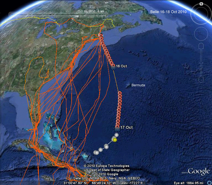 |
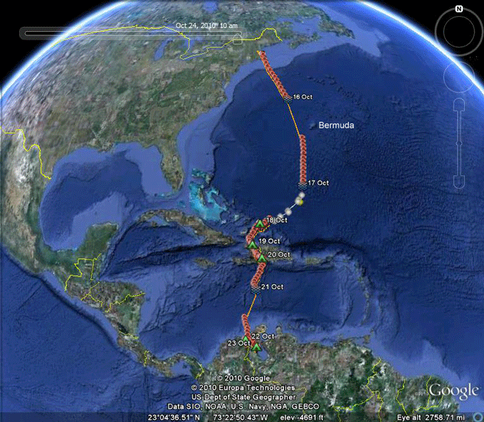
16-18 Oct 2010. Belle started her first
migration a little after 7 AM on the 16 and was rocketing south at about
40 miles (64 km)/hour, which is really fast. She obviously had a very
strong tailwind. In fact, the wind was so strong on the 16th that they
closed the Martha's Vineyard Airport. With tongue firmly in beak, I'm
not sure she actually meant to start migrating--she might have just
gotten up in the air and all of a sudden found herself out over the
Atlantic. This sort of thing does get many young Ospreys on their first
flight, when they hover over the nest and a gust of wind blows them to
one side so they can not just hover back down to the nest, they are
suddenly put to the test. The first flight always looks great. The first
landing is often rather comical. |
|
This is a little late to be starting a migration.
Most of our juveniles leave in the first two weeks of September.
However, she's nowhere near the record (15 November) set by her sister
Meadow back in 2008. Runner up in the "Last one out turn off the lights"
contest was Luke, another Lake Tashmoo bird, who left the Boston area on
7 November a few years back. While Belle was heading south across the Atlantic, reliable sources report lots of Ospreys hanging around Woods Hole, just north of the Vineyard. These are probably birds from the area as well as some coming in from up north. Once she got going, she just missed Bermuda (by 200 miles) some time in the wee hours of the 17th. At some point in her travels (around Bermuda's latitude) she would have run into the trade winds, which would have nudged her west towards the Bahamas. Her GPS was shut down while she was sending her data up to the satellites during the night of the 17th. Fortunately, while the satellite is uploading her GPS data, it does the Doppler shift thing and figures out where the transmitter is. The colored dots are these Doppler locations. She lost those strong tailwinds somewhere along the way. Her overall average speed was a still very respectable 32 miles (51 km)/hour. I hate to map my Ospreys before they've landed, but... assuming she was two hours short of landfall, she should have landed around 8AM, about 49 hours after taking off from Martha's Vineyard on the 16th. About all those other lines--those are tracks of all the other young we've tagged over the years (since 2004). Belle certainly pushed the eastern envelope. |
|
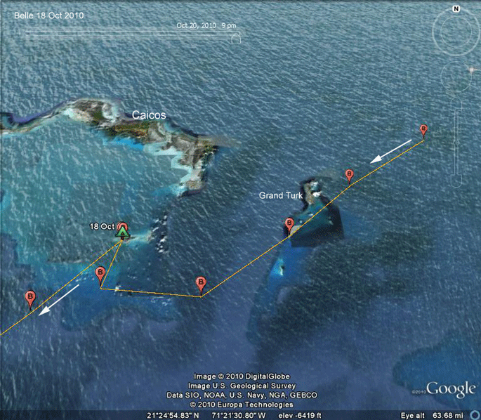 |
18 Oct 2010. In a very macho move, Belle didn't even stop to rest at her first opportunity, which would have been the rather presumptuously named Grand Turk Island. So after 49 hours of non-stop flying, she easily had another couple of hours in the tank. She did finally haul up and settle on a tiny island (too small to get a name that Google knows about). She landed there around 1PM, presumably did some fishing, and then took off around 10AM the next day. |
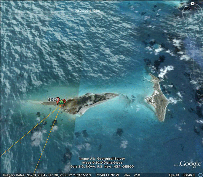 |
18 Oct 2010. Belle took a well-deserved rest here. |
 |
18-19 Oct 2010. Belle made landfall on Haiti around 3 PM on the
19th. She pushed on for another four hours and then roosted in the hills
northeast of Dessalines in Haiti. She was on the move again around 9 AM,
heading southeast by south towards the Caribbean. When she got to the southern coast of Haiti, she applied the "but stay over land" clause to her instinctive urge to go south, and headed down towards Cabo Beata (which I have misnamed in these maps a few hundred times "Cabo Beato"). She roosted in the Dominican Republic and, according to our latest Doppler locations, she was off on her way to Venezuela out over the Caribbean around 11 AM. This is only her 5th day of migration. Pretty impressive. Scroll down for the weather report. (The blue locations are Neale's wanderings.) |
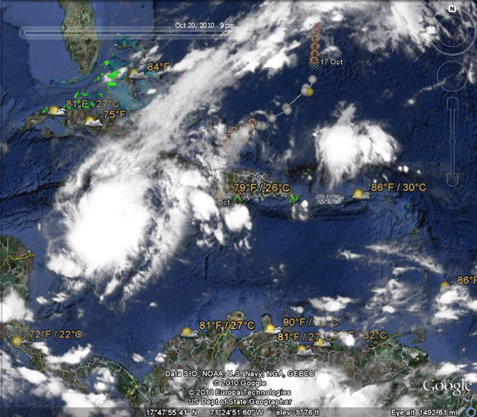 |
21 Oct 2010. It looks like she should have clear sailing as she pushes on with her migration today. You can just see her roost spot below the "79," just west of the storm system. She has clear skies between Hispaniola and South America. |
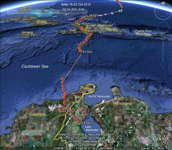 |
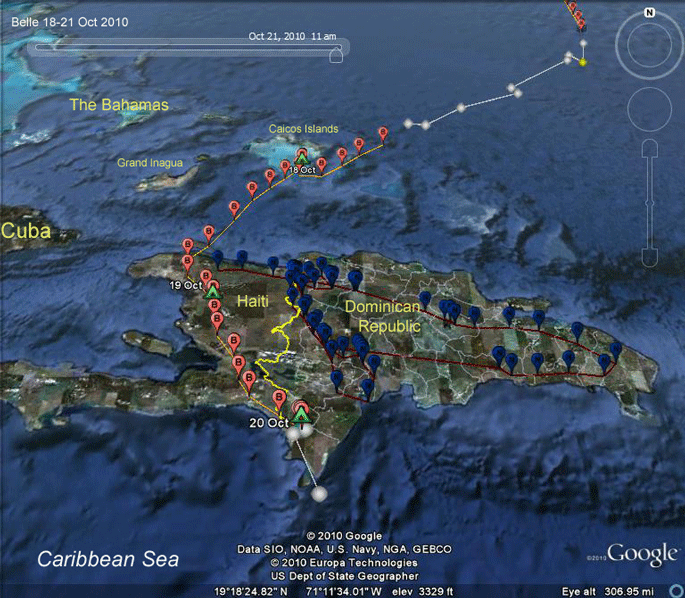
18-23 Oct 2010. Piece of cake! Belle left her roost in the southern Dominican
Republic around 9 AM on the 21st. She was out over the water about 2
hours later and 27 hours later crossed into Colombia. Her zig-zaggy flight suggests that winds were changing as she crossed the Caribbean. Judging by the distances between hourly fixes, if she stopped to rest at all when she got to the shores of South America, it was only for a few minutes. She seems to have just kept on going for another 3 hours, finally settling down between Valledupar and La Paz on the 22nd. |
 |
16-20 Oct 2010. Here's the whole trip so far. She was farther east than any of our youngsters have been. |
 |
23 Oct 2010. Around 10 AM on the 22nd she was off again, this time heading east over the Cordillera Oriental, the eastern branch of the Andes mountains, and down into the T�chira Basin (more on this below) almost to Lake Maracaibo. Another hour and a half on that flight path and she would have run into our 2009 juvenile Buck (the hot pink balloons), who is biding his time down there waiting to head home next spring. |
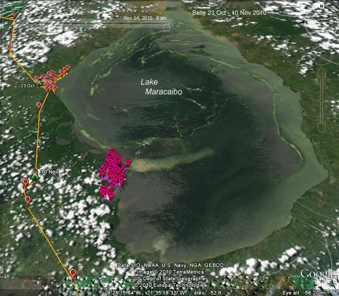 |
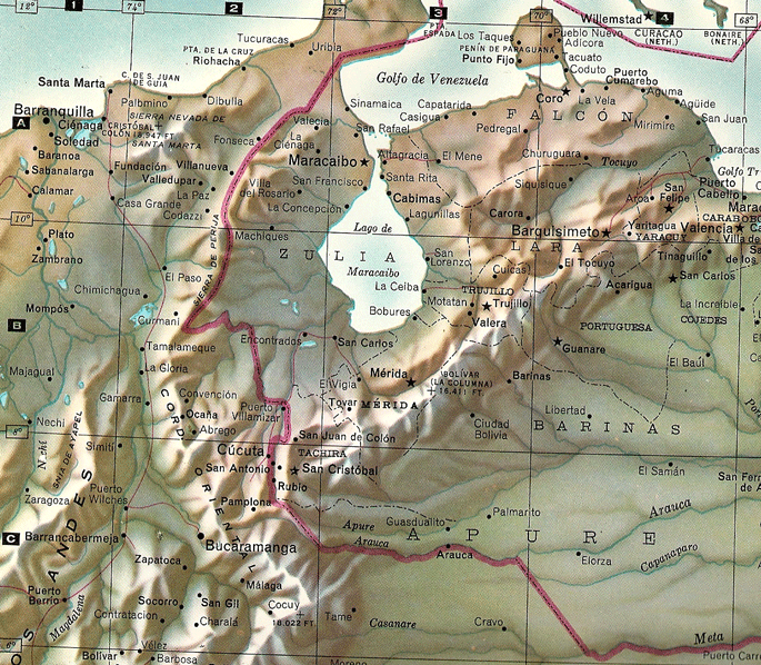
23 Oct-10 Nov 2010. Belle spent 17 days on the western shore of Lake
Maracaibo, in northwestern Venezuela, just 40 mi (67 km) north of Buck's
headquarters. Lake Maracaibo is a large brackish lake in Venezuela. It is connected to the Gulf of Venezuela by Tablazo Strait (55km) at the northern end, and fed by numerous rivers, the largest being the Catatumbo. It is commonly considered a lake rather than a bay or lagoon, and at 13,210 km� it would be the largest lake in South America. The geological record shows that it has been a true lake in the past, and as such is one of the oldest lakes on Earth, it's 20-36 million years old. |
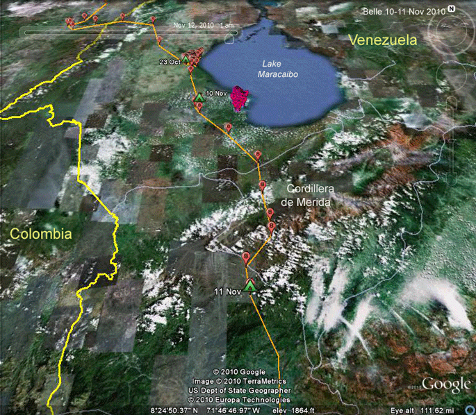 |
9-11 Nov 2010. Lake Maracaibo lies in a basin flanked to the west by the Cordillera Oriental (the Eastern Range) of the Andes, and to the south by the Cordillera de Merida. To get further south on the continent, an Osprey has to cross over two mountain ranges, as described in the Wikipedia entry below: The Cordillera de M�rida is a series of mountain ranges, or massif, in northwestern Venezuela. The Cordillera de Merida is a northeastern extension of the Andes Mountains. The ranges run southwest-northeast between the Venezuelan-Colombian border and the Venezuelan coastal range.
|
|
|
[more from
Wikipedia:] The
Tachira depression
separates the Cordillera de Merida from the
Cordillera Oriental,
which forms the Colombia-Venezuela border.
The ranges runs from southwest to northeast.
The southeastern slopes are drained by tributaries of the Orinoco River,
while the streams that drain the northwestern slopes empty into Lake
Maracaibo. At the northeast tip of the massif lies the town of
Barquisimeto and the headwaters of the River Cojedes. In the centre of the massif is the city of M�rida. Two ranges of peaks lie on either side of the city, the Sierra de la Culata to the north and Sierra Nevada de Merida to the south. Pico Bol�var, at 4,981 meters elevation (16,342 feet), is the highest peak in Venezuela. |
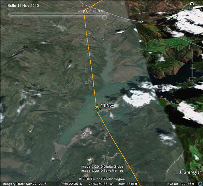 |
11 Nov 2010. Belle spent the night and early morning at this
reservoir high in the middle of the Cordillera de Merida.
She probably arrived around 6 PM and was on the wing around 8 AM on the
12th. She would have had time to do some fishing before heading up over
the Sierra Nevada de Merida. South of those mountains lie the Venezuelan llanos and then the vast Amazonian rainforests of central South America. |
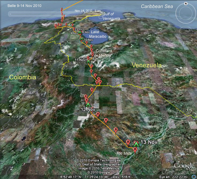 |
9-13 Nov 2010. Belle was over the mountains by 10 AM and heading
south. She got to the Arauca River, which forms the border between
Colombia and Venezuela around 1 PM and probably did a bit of fishing. A
couple of hours later she was on the wing again, heading into Colombia. Her roost on the 12th was covered by pretty thick clouds when the satellite images for the area were taken, so we'll skip that stop. |
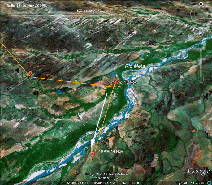 |
13-14 Nov 2010. Here's a close up of the Rio Meta valley, with open llanos laced by riparian forests to the southeast and another strange dune-striated habitat north of the river. She was off to the races just after 9 AM. She'll probably be in the Amazonian forests by early afternoon. Unless she gets distracted, but she seems to be a bird on a mission these days. |
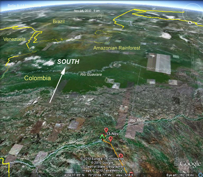 |
14 Nov 2010. (looking south) On the 14th Belle was heading south after a night on the Rio Meta when we got our last GPS fix. She has about 80 miles (130 km) to go before she hits the Amazonian rainforest in southern Colombia. The intervening land has lots of water-both standing water and rivers lined by narrow forests, interspersed with open land, which I guess is mostly cattle land. The human population looks to be very sparse, but it's there. So far, over 29 calendar days, of which she's been migrating only 12, she has covered 2,910 miles (4683 km). |
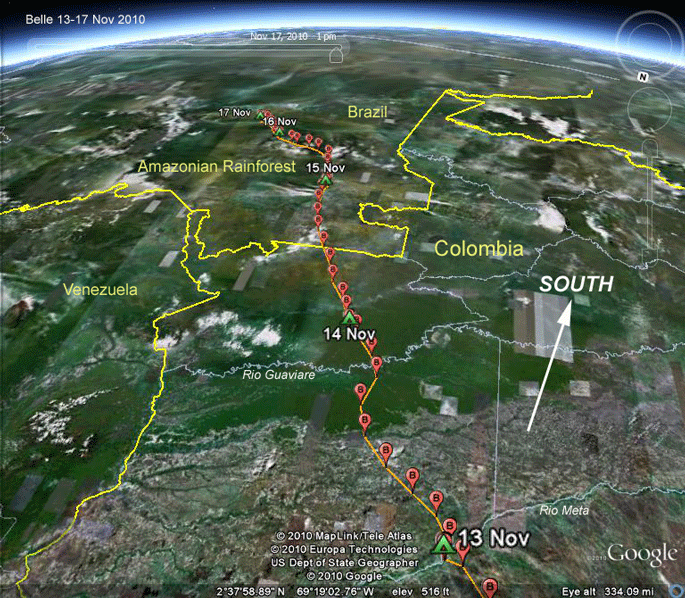 |
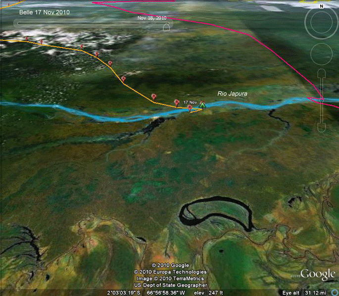
13-17 Nov 2010. (looking south) On the 14th Belle indeed crossed into the enormous Amazonian rainforest. In these four days she covered 604 miles (1000 km) and reached the Japura River, just north of the Amazon River, deep in the heart of the Brazilian Amazon. |
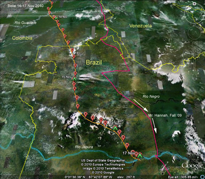 |
17 Nov 2010. (looking north) Same trip as the last map, but back to our more conventional view, looking north. The hot pink track is Mr. Hannah's trip south a year ago. |
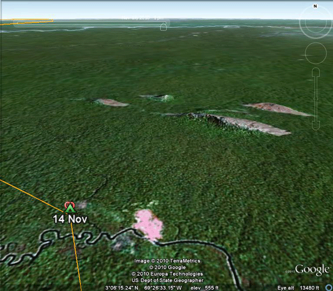 |
14 Nov 2010. Scattered around the Amazon are all sorts of strange geological formations, like these rocky outcrops close to Belle's 14 Nov. roost in Colombian Amazonia. |
 |
15 Nov 2010. (looking south) Now we're in the northwestern Brazilian Amazon and Belle's flying through a very strange landscape. Soils in this region tend to be really sandy, which explains the black (negro) water in the Rio Negro. Rivers that drain sandy areas (closer to home, the New Jersey Pine Barrens are a classic example) are black because the water is rich with tannic acids. Tannic acids are compounds that plants create to keep bugs from eating them. Why so much tannic acid in sandy soil areas? Either the soil doesn't hold the molecules of tannic acid well (everything just leaches through really sandy soil) or plants growing in nutrient-poor sandy soils invest more of their available energy into defending their leaves by creating lots of tannic acid because it's so expensive to replace leaves eaten by insects. |
 |
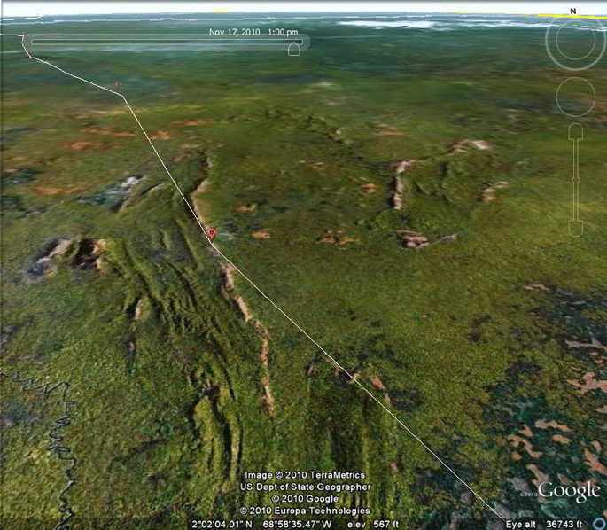
17 Nov 2010. The landscape of Amazonia is infinitely fascinating. A few words here on these satellite images are worthwhile. Satellite photography comes in as a bunch of 1s and 0s (it's digital) representing different wavelengths of light picked up by the cameras. These binary data have to be interpreted and turned into colors. Typically, the data coming in from forests are set to green, and other colors can wind up being really different from what they really should be. The apparently blue water in the Rio Japura here is a case in point. The water in this river is actually 'cafe-au-lait' colored. The river carries a lot of sediment, so in reality, it's a silt-laden very light brown color. Flying over this patch of forest looking out the window of a jet, you wouldn't see such dramatic differences in the green of the forest. It would all look green. Differences in wavelengths of light that we can't see affect the digital image. So subtle differences in forest structure are accentuated in these satellite images. Cut and paste these coordinates into Google Earth and browse around. Look closely for evidence of how the rivers have meandered around the landscape creating what we see here: -1.85367N 66.88900W |
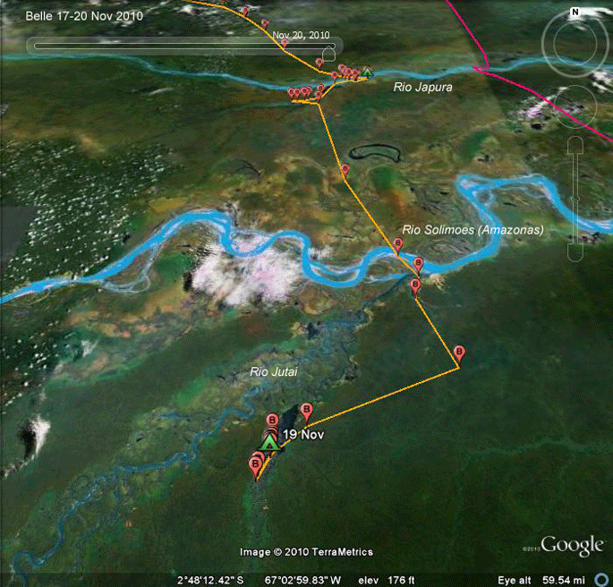 |
17-20 Nov 2010 Belle crossed the Amazon (Brazilians call it the Solimoes around here) on the 19th. She's now farther south than any of our juveniles. She's 72 miles (117 km) west by northwest of Mr. Hannah's wintering grounds. |
 |
19-20 Nov 2010 Now this looks like a good spot to spend the next 18 months! Rivers that show up blue on these maps have their headwaters in higher elevations. This means they build up a head of steam as they flow and thus pick up a sediment load, which makes them "white water" rivers, even though at this point there isn't a rapid to be found for hundreds of miles. The darker rivers have their headwaters in the lowlands, so they never build up enough speed to pick up any sediments. Instead, they tend to be dark, rich with tannins. Either way, it's hard for an Osprey to see far into the water, which makes fishing not as easy as one might suppose. |
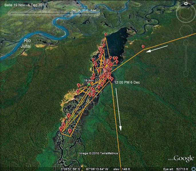 |
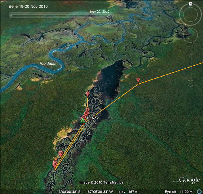
19 Nov- 6 Dec 2010 After 17 days on this lake, it looked like she was going to stay here. However, true to form, on Dec 6th, she took off and headed south again! |
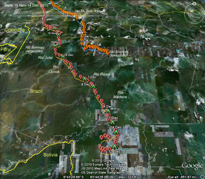 |
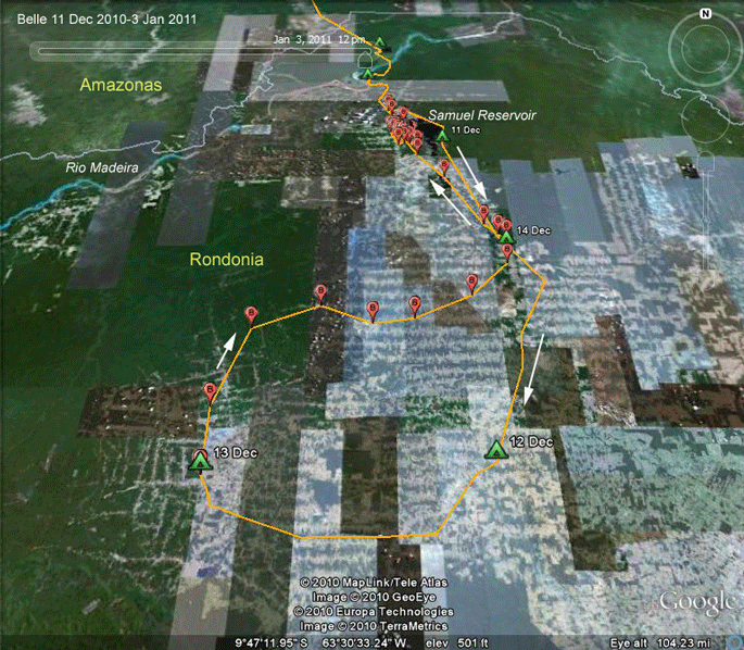
19 Nov-14 Dec 2010 Over an 8-day period, Belle pushed southeast through the southern state of Amazonas and on into the Brazilian state of Rondonia. At the same time, Thatch, our 2010 juvenile from Delaware also made a move from his spot on the Rio Tefe. |
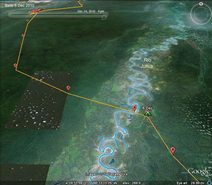 |
6 Dec 2010 Not surprisingly, Belle stops at the end of each leg of migration at one of the big rivers that feed into the Amazon. The change of course is interesting here. Most likely, at some point she got high enough and close enough to the Jurua that she could see the river and diverted over to it. She arrived at the Rio Jurua around 5PM local time on the 6th and settled down for the night. |
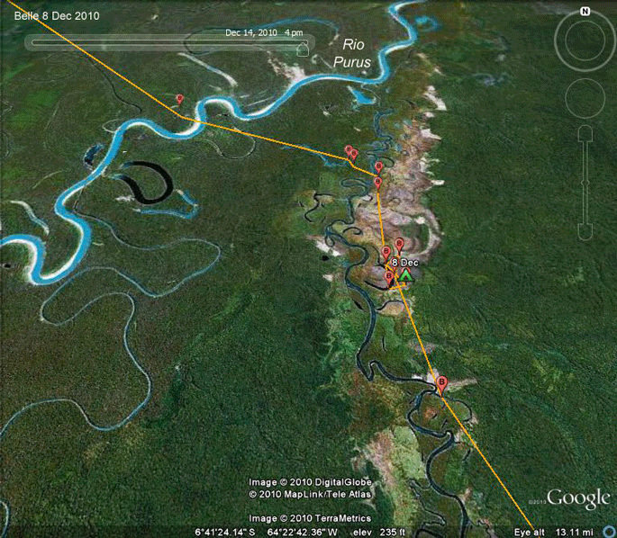 |
8 Dec 2010 After flying 175 miles (282 km) during the day Belle spent the night of the 7th on a tributary of the Purus and kept moving the next morning. She crossed the Rio Purus around 12:00PM and settled down on another small tributary after a short daily move of only 52 miles (83 km). |
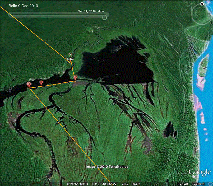 |
9 Dec 2010 She arrived at this strange area just west of the Rio Madeira around 5 PM after a flight of 125 miles (202 km). |
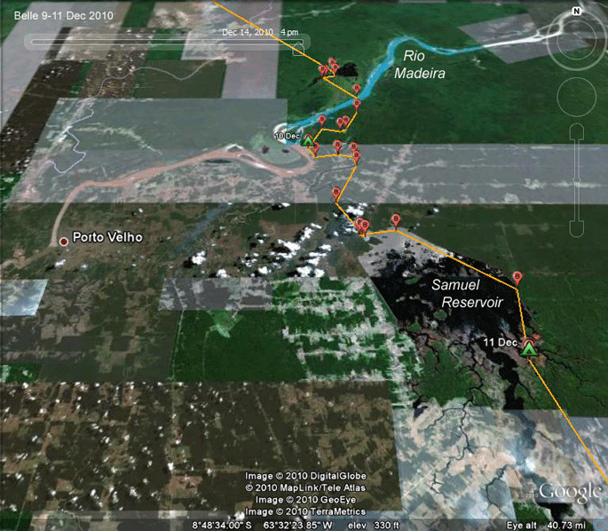 |
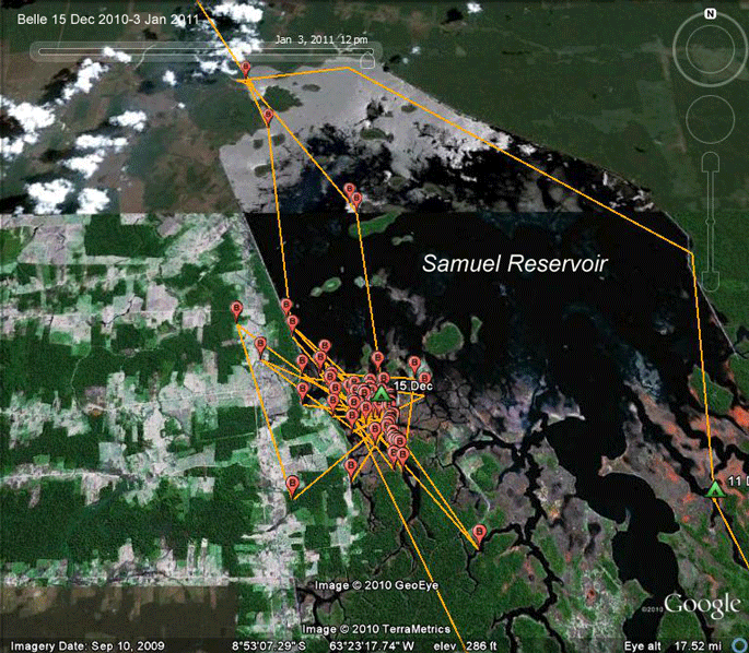
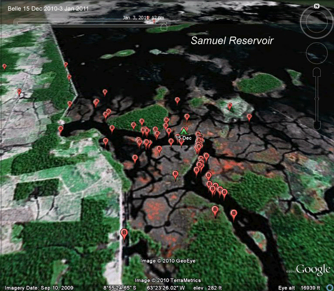
10-11 Dec 2010 Belle crossed the Rio Madeira and entered the Brazilian state of Rondonia on the 10th. She moved a bit farther south on the 11th, discovering the Samuel Hydroelectric Reservoir. Apparently not impressed, she pushed on around noon the next day. |
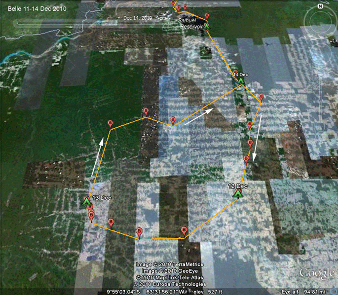 |
11-14 Dec 2010 This is the first time Belle has spent a few days exploring and looping back to someplace she'd been before. This is the farthest south any of our birds have been and the longest migration we've seen. Belle left home 60 days ago. Of those, she has spent only 25 actually migrating and 35 resting or exploring the local possibilities. Since she left home, she has flown about 4,275 miles (6.878 km), averaging 171 miles (275 km)/day of migration. |
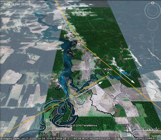 |
14 Dec 2010 Belle is back to a place she saw a few days before on the small river that feeds the Samuel Hydroelectric Reservoir. A few words on the landscape here in Rondonia. This was one of the first areas in the Brazilian Amazon where deforestation really took hold. While not this extensive, the clearing we see here was well under way when I moved to the Amazon way back in 1979. It was a government sponsored colonization project, spurred by the creation of a network of roads, which gave colonists access to a vast area of virgin rainforest. |
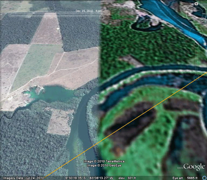 |
Satellite imagery In case you've been wondering why the maps we've seen across the Amazon have a checkerboard appearance, here's what's going on. The images we see are composites of many images. Early images were pretty low resolution. Gradually, as higher resolution images become available, they are pasted into the composite image we see on Google Earth. This image shows the seam between an old image (on the right) and a new one (on the left). Notice that the large clearing north of the river had not been opened when the first picture was taken. |
 |
15-31 Dec 2010 Belle is back to a place s |
 |
15-31 Dec 2010 Belle is back to a place s |
 |
15-31 Dec 2010 Belle is back to a place s |
Birds of Prey page -- Osprey main page -- Migration page -- Home Page